LIVING, Recipes, baking-in-france, baking-in-the-vendee, bread and hot chocolate, bread. home-made bread, European style milk bread ingredients, home made bread, homemade bread, how do I make bread, how to bake bread, how to bake brioche style bread, I-love-baking, is milk bread just brioche, milk bread, why is milk bread so good, wintery bread
Activities guide to the Massif Forestier de Mervent-Vouvant
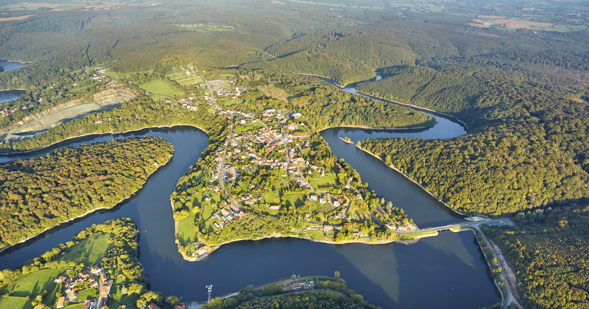
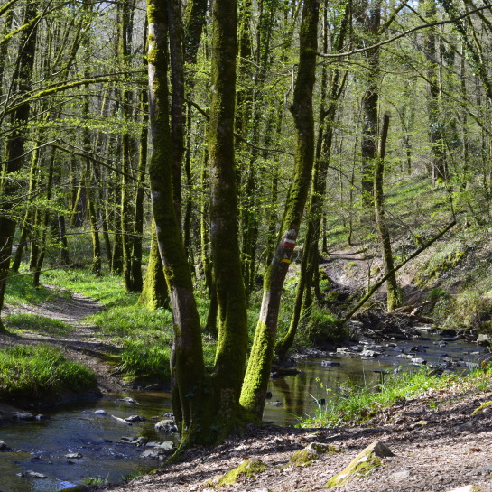
In south-Vendée where the rivers Mere and Vendée converge lies a hilly forest of some 55 square kilometers called Le Massif-Forestier de Mervent-Vouvant. It consists of accessible private and public domain and contains nine villages: Mervent, Pissotte, Bourneau, L'Orbrie, Foussais-Payré, Saint-Michel-le-Cloucq, Saint-Hilaire-des-Loges, Xanton-Chassenon, and Vouvant - one of France's most beautiful. The villages are mere dots, leaving 5519 hectares of dense forest featuring beautiful hardwood trees. Whether it's your first visit or your fiftieth, as soon as you step foot beneath their canopy and lay eyes on meandering brooks sounding like little bells, and the abundant carpet of wildflowers, realization will strike that this forest exudes something absolutely magical. Whether you live in the Vendée year-round or like to visit with the seasons, these woods hide a plethora of activities to please the solo adventurer, the athlete, and the whole family. Use images below (and the UP arrow) to easily navigate our guide, or scroll through.
A brief history of the forest –
At the beginning of the 11th century it is said that the Count of Poitiers and Duke of Aquitaine, William the Great, became aware of the rocky ridge formation surrounded on three sides by the river Mere. The area was an excellent point of strategy against invasion (of the Normans at the time).
Together with the Abbot Théodelin de Maillezais, William ordered the construction of a church, a monastery, and a fortified castle (the very first structure would have been made of wood though) atop the mountainous ledge at Vouvant.
This ensured control over the Bas-Poitou area and the great forest on the other side of the river. Eventually there were several fortified castles in the surrounding area, remnants of which exist in Vouvant, Mervent, Bourneau etc.
Jean-Baptiste Colbert (1619-1683), First Minister of State under King Louis XIV from 1661 until his death in 1683, developed the Mervent - Vouvant forest as a Royal Domain. Then called le Forêt Royale de Vouvant, this forest served for tree harvesting to supply the Rochefort Arsenal building of France's vast navy fleet. After the revolution, the forest became the Imperial Forest of Vouvant. It wasn't until 1965 that the name changed to Forêt-Masif de Mervent-Vouvant.
Remarkable trees –
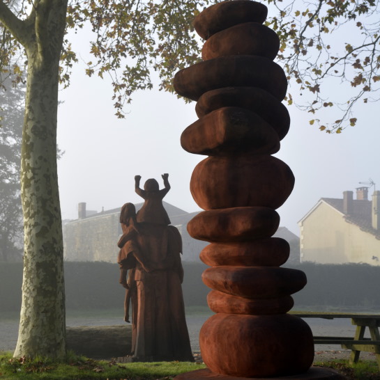
Jean-Baptiste Colbert was aware that harvesting century-old oaks would become problematic for the future of the forest and planted new ones. There is one tree remaining from the 17th century, named the Mariner oak. It is thirty meters high and classified in the National Forest Inventory. Other remarkable trees to discover in the forest are the Hermit's oak, and the five-trunk oak. The latter is quite unusual as it developed five stems from the same bole. After the tree died (1996), artist Sébastien Krampe transformed "the five twins" into an exquisite sculpture that seems lifted from a fantasy story and planted here to put a definite stamp of enchantment on the forest.
Aerial image credit – Alexandre Lamoureux
Open year-round
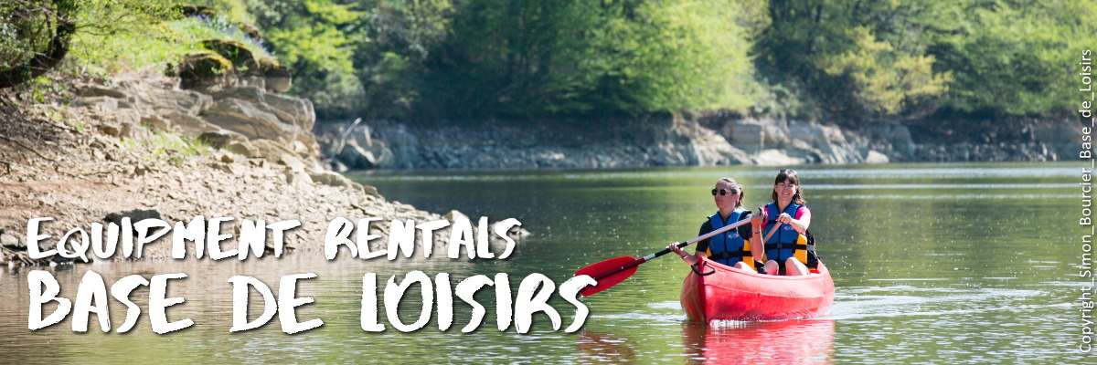
Base de loisirs Mervent
Make reservations for equipment and/or opportunities to learn a new discipline such as archery. The leisure center on the banks of the Mervent lake offers the opportunity to rent a bike, paddle board, canoe, kayak, electric boat, sailing dinghy, and learn archery, climbing, mountain biking, orienteering, etc.
Open year-round (off season by reservation) – website
Address – 150 route touristique, 85200 Mervent
Telephone – (033) 02.51.00.22.13
Email – basedeloisirs@fontenayvendee.fr
Online reservations – here or here (includes opening hours)
Directions – enter your point of departure
GPS coordinates – 46.524238437083255, -0.7572130695686299
Other – pedalos rental (Chill-Out)
Languages – French and English
Groups – fill out the contact form
Tourism & Handicap – special care and services for the motor, mental, auditory and visual impaired. Most activities can be adapted and are provided with supervision (from 6yrs old). Most provide appropriate shoes and clothes.
Espace de Loisirs du Lac Chassenon
Located between the villages of Saint-Michel-le-Cloucq and Saint-Hilaire-des-Loges in Xanton-Chassenon offers more opportunity for family fun. Lac Chassenon base the loisirs features nice swimming area with sandy beach, waterslides, and games for children. Cycling, pedalos for hire, restaurant and bar, shaded picnic tables... A great place to spend the day or an afternoon with views of the forest.
Open seasonally – from 19/06/2021 to 12/09/2021
Address – Prairie de l’Aiguille, Route de Parthenay, 85240 Xanton-Chassenon
Telephone – (033) 02 51 69 83 74
Directions – enter your point of departure
GPS coordinates – 46.487873829545926, -0.7071801182863642
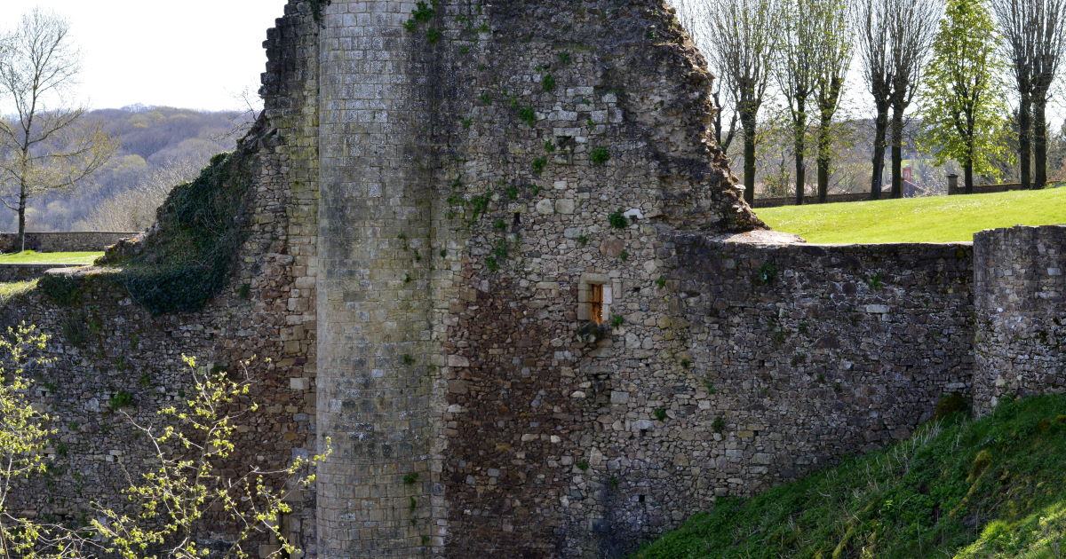
Vieux château de Mervent
The oldest documents in which a castle is mentioned here date to the 11th Century (1018 and 1022) and was it probably a castrum - a wooden castle built on an earthen mound and surrounded by a wooden fence. The documents (charters speaking to a donation made to the Abbaye de Maillezais also mention mills and a chapel.
The stone castle of which we can see the ruins today probably dates to the late 12th or early 13th century, owned by the Lusignan family that also held the castle in Vouvant.
The last inhabitant of this castle would have been the Duke Jean de Dunois, better known as the Bastard of Orléans, a French military leader who led campaigns with Jeanne d'Arc during the Hundred Years War. Jean de Dunois was the illegitimate son of Louis I, Duke of Orléans and his mistress Mariette d'Enghien. His grandfater was King Charles V of France.
After the death of Jean de Dunois, the castle was forever abandoned.
Open – Ruins and park. A limestone tower, and some ramparts with towers remain, as well as the stunning panoramic views over the Mère river valley and the forest.
Local legend and folklore – Read about the legend of the Fairy Mélusine in our article.
Address – Chemin des Douves, 85200 Mervent
GPS coordinates – 46° 31′ 26″ N, 0° 45′ 24″ W
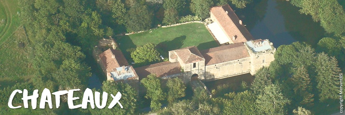
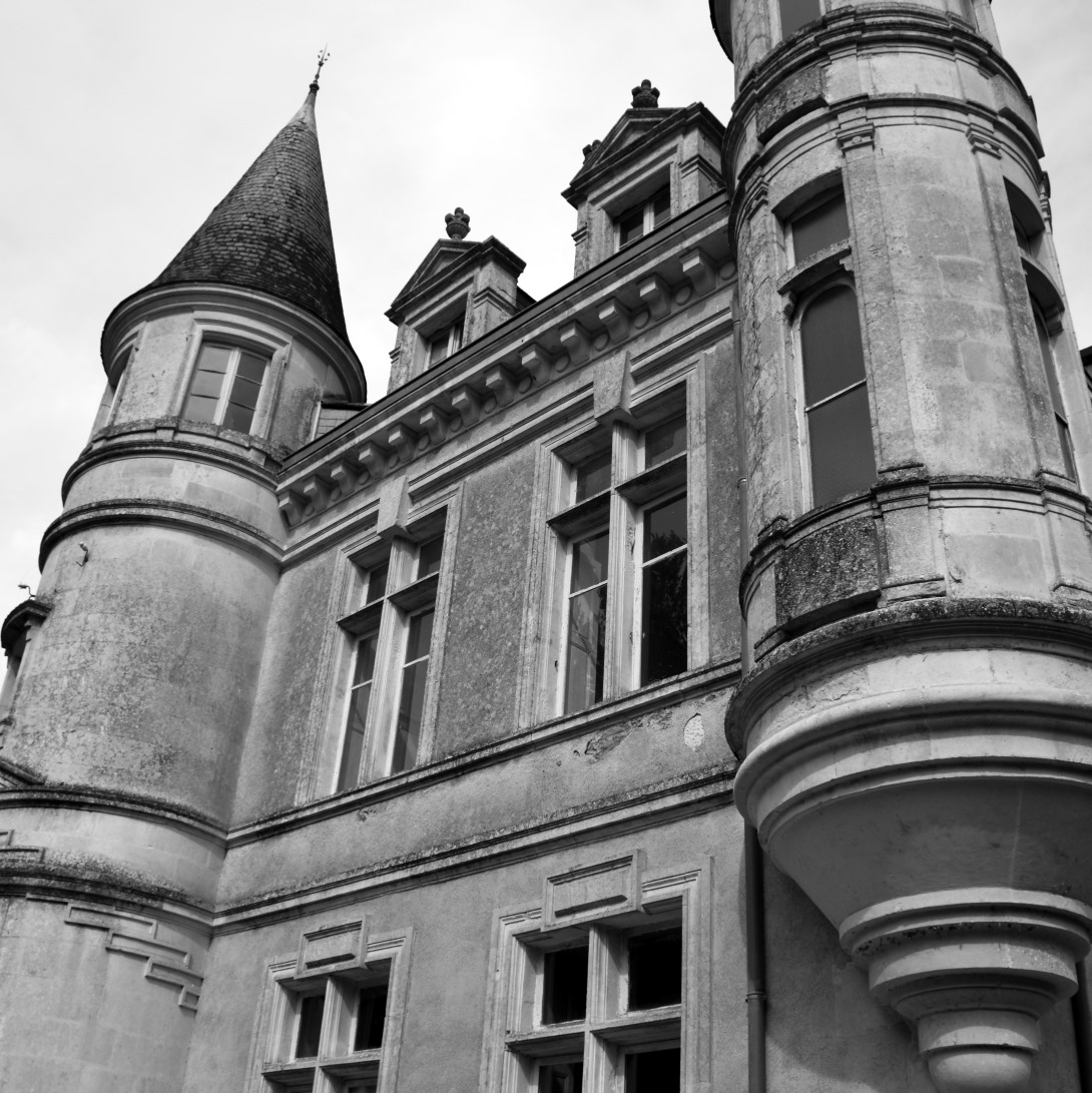
The private châteaux
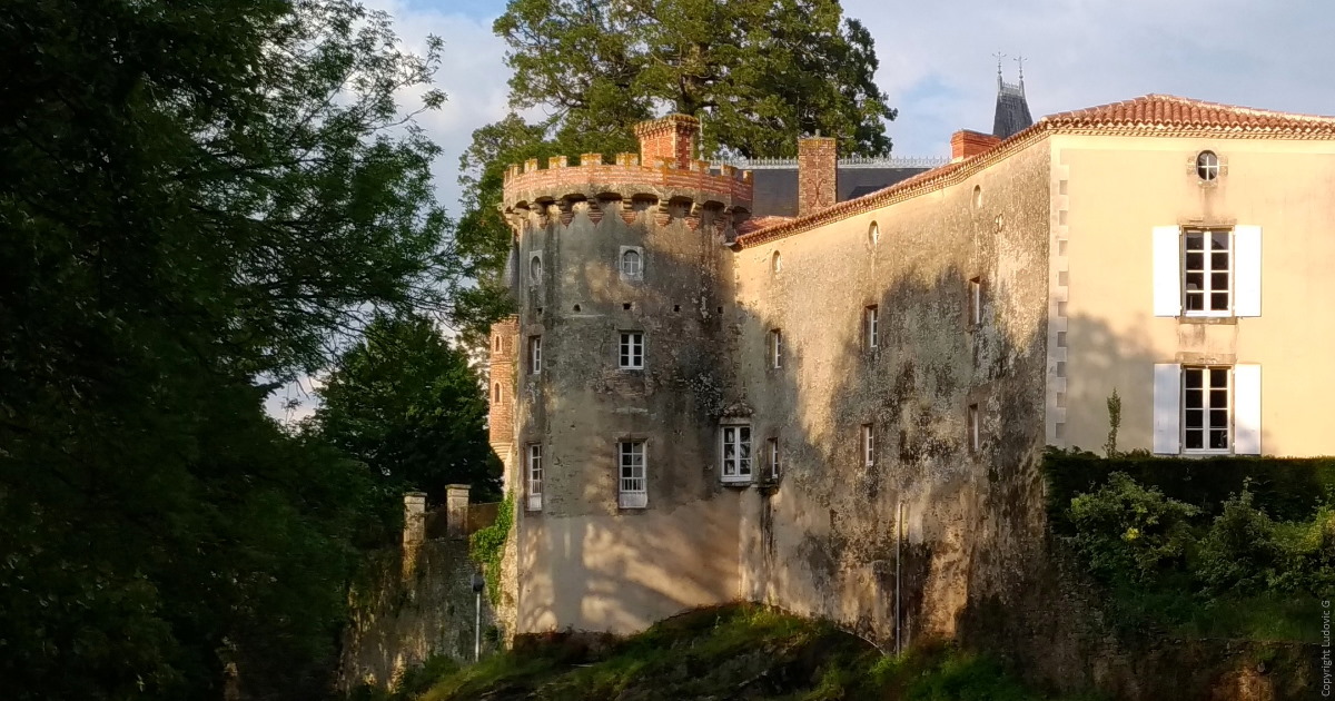
Château de la Citardière
Once wildly overgrown, this interesting castle was purchased by a young French couple and has gone through a thorough make-over. This historical monument, an unique castle whose origins rest in the 14th century, was largely destroyed in the Wars of Religion.
What you see today largely dates to the 17th century. The impressive castle including square defensive towers, large artillery room, and courtyard make it, in its current life, an ideal wedding and events venue. A double arched narrow bridge connects to the entrance of the chateau, which is surrounded by a beautiful moat.
Open – Private property, not open to the public. You can catch a glimpse from the street.
Address – Chemin de Chantoiseau, 85200 Mervent
GPS coordinates – 46° 32′ 03″ N, 0° 44′ 24″ W
Website – Château de la Citardière
Social Media – Instagram
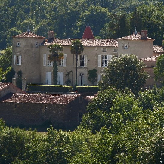
Château de Bourneau
This lovely Renaissance château was constructed in 1863 on the foundations of a medieval fortified castle dating back to 1464. You might recognize its architectural inspirations in Château Azay-le-Rideau and Château d’Anet in the Loire Valley. Château de Bourneau is now a private family home and events business, and includes holiday cottages.
Private – Catch a glimpse driving through the village
Events – The owners sometimes organize events open to the public such as plays or picnics. May be open for Journee des Jardins in spring and Journees du Patrimoine in September
Address – 85200 Bourneau
Website –Château de Bourneau
Social Media – Instagram
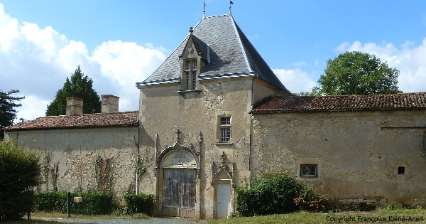
Château de la Recepte
The Château de La Recepte was built in the 19th century on the famous medieval ramparts of Vouvant near the old Porte de Bouguerin, one of three gates that allowed entry to the fortified village. The park contains the best-preserved towers of the 12th and 13th century fortified wall surrounding Vouvant. Several of the towers have their original vaulted rooms accessible at ground level of the courtyard. The remains of stone corbels supporting the walkway are still observable.
Private – Catch a glimpse from the street.
Events – owners organize the occasional summer concert or picnic in the gardens, may be open for Journee des Jardins in spring and Journees du Patrimoine in September
Address – 85120 Vouvant
Château de la Baugisière
In the XIIIth century a castle was already located here. The current installment was built in 1741 by the knight Maximilien Boutou de La Baugisière, husband of Suzanne Fleury de La Caillère. The current owners restored the chapel in honor of the wedding of their daughter.
Private – You can only catch a distant glimpse, in fact this chateau could easily be a part of our "Hidden Corners" article. The park is open to visitors a few times each year (e.g. Journees Patrimoine and Rendez Vous au Jardins)
GPS – 46° 29′ 01″ N, 0° 44′ 00″ W
Address – 85200 Saint-Michel-le-Cloucq
Other chateaux in this village include Chateau du Bourg, Château du Mazeau (see link for restoration progress), Château de Beaulieu
Images by wikimedia (Grignonniere, de la Recepte, Bourg) and inthevendee.com (Bourneau, Baugisiere, and Mervent)
Chateau de la Recepte
Vieux Chateau de Mervent
Chateau du Bourg
Château de la Grignonnière
Chateau de Bourneau
Château de la Baugisière
A tour of discovery
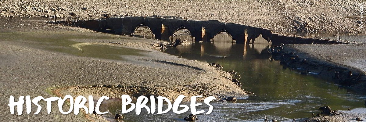
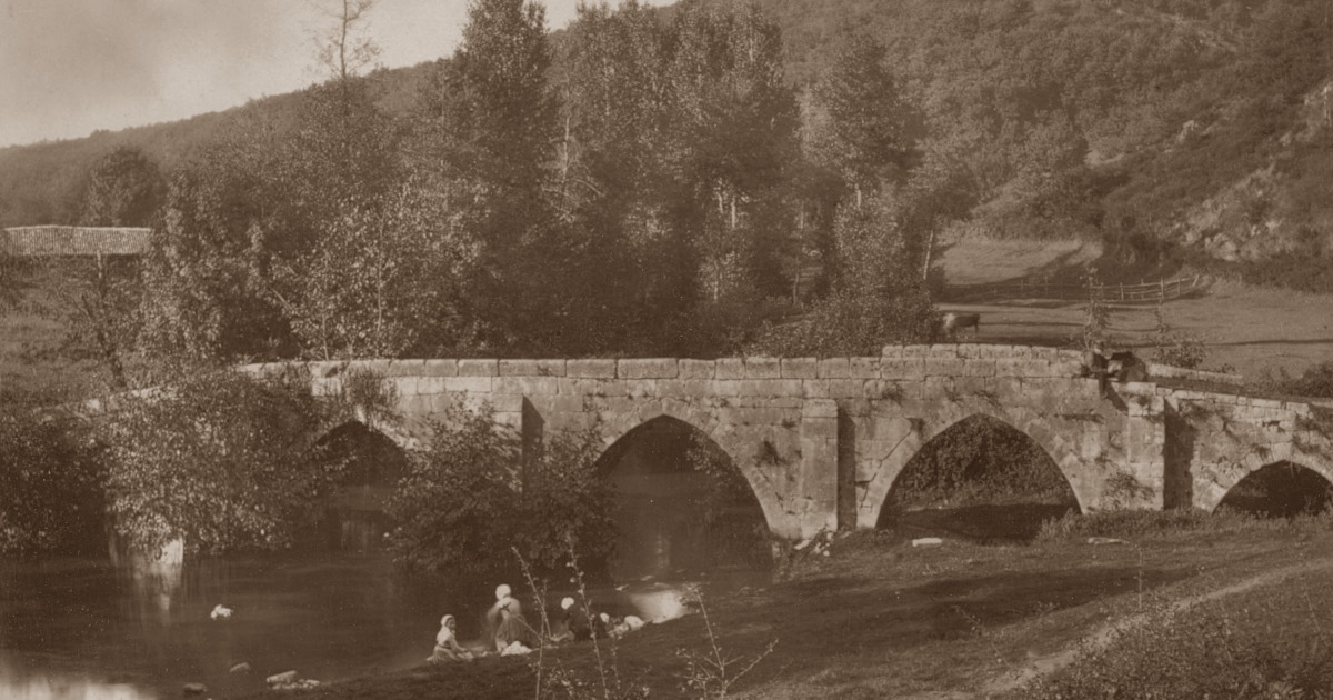
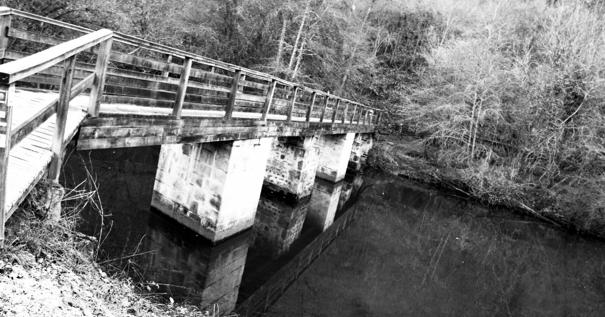
Vieux Pont des Ouillères
Once the only entrance to Mervent, this bridge made of stone from local quarries was built across a shallow point in the Mère river. Its distinctive look featuring five arches, parapet, and four starlings on the bridge-face show some parts of the bridge date to the 13th century and some to the 15th. After the construction of the dam in 1956, filling the reservoir, this beautiful gothic monument became completely submerged. Attempts and requests to move it elsewhere for its preservation have unfortunately been refused. A local legend relates that the devil, exhausted from a long journey, sat on a stone downstream from the bridge and left an imprint.
Tip – The bridge becomes visible on the rare occasion that the reservoir is drained. The information we could find reveals that every 10 years or so, the draining of the lake and reveal of the bridge draws huge crowds, some traveling great distances to see it.
More reading – old newspaper clippings (click to see image)
GPS coordinates – 46° 31′ 21″ N, 0° 44′ 54″ O
Directions to Vieux Pont des Ouillères – enter your location
Image – by Jules Robuchon (end of 19th century)
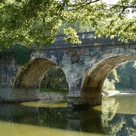
Vieux Pont de Vouvant
Dated between the 13th and 15th centuries this bridge was a point of access to the Porte aux Moines (destroyed in the 19th century), one of the three entrances to Vouvant in the Middle Ages. The bridge spans the river Mère and has three arches, two with round openings, and one pointed, and has starlings to ease the flow of the river. The bridge became a historic monument in 1927. The "Pont Moderne" - the new bridge within a stone's throw (route RD31) was constructed in the 19th century.
Nearby – The old lavoir (laudry basin)
GPS coordinates – 46° 34′ 18″ N, 0° 46′ 00″ O
Directions to Vieux Pont de Vouvant – enter your location
Image – by inthevendee.com
Ponts du Déluge
This beautiful bridge was built around 1860 under Napoleon III. It bears the initials of M. de Villeneuve (engineer of Water and Forests) and was constructed to span the steep valley across the Verreries stream. It has a 202.5m long parapet and measures 13.25m high.
Nearby – Beautiful walking trails
GPS coordinates – 46.538600705901636, -0.7589108306836809
Directions to Pont de Déluge – enter your location
Image – inthevendee.com
Pont de Diet
The Diet bridge with its two round arches also spans the river Mère. Its central pier bears a medallion dated 1863.
GPS coordinates – 46.533850187731055, -0.7739245877159411
Directions to Pont de Diet – enter your location
Image – Mervent85
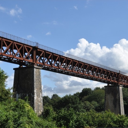
Le viaduc de Baguenard
Spanning the Petit-Fougerais, a side-river of the Mère, this bridge was constructed to allow train traffic between Fontenay-le-Comte and Breuil-Barret. The impressive bridge realized by Ponts et Chaussées engineers Jules Dingler, Alexandre Prompt and Albert-Marie de Préaudeau measures 196m in length and 35m high, weighing 500 tons. Taking nearly three years to construct, the bridge went into service in May 1880. The company Daydé et Pillé was responsible for building the metal deck which was slid into place from the embankments across the masonry pillars. In 1944, the Allied forces meant to bomb the bridge to keep it from being used by the Germans, and missed its, killing a family that lived nearby. The bridge was in use until 1954.
Nearby – Petit-Fougerais
GPS coordinates – 46.56437905657387, -0.7979903019715032
Directions to Viaduc de Baguenard – enter your location
Image – Pmeunier23
Pont de Deluge
Viaduc de Baguenard
Pont de Diet
Vieux Pont des Ouillères
Vieux Pont de Vouvant
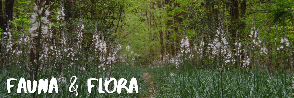
Fauna and flora
Species of trees that grow in the Mervent forest include beech, birch , cherry, chestnut, hazelnut, hornbeam, mountain ash, and oak trees indigenous to temperate regions in the northern hemisphere. The trees offer shelter and shade to numerous animals from rabbits to deer and wild boar.
More exotic species live at Natur'Zoo deep in the heart of the forest.
In spring and summer the forest is carpeted with a variety of wild flowers like wild Hyacinth (bluebells), Wild Garlic, Lily-of-the-Valley (Muguet), cornette (Common Columbine), Irish Spurge, Yellow Dead nettle, White Asphodel, Male Orchis (wild orchids).
Wild orchid, yellow dead-nettle and purple dead-nettle are edible. We have tried this delicious and healthy Wild Garlic & Nettle Soup but we recommend foraging for these plants in the countryside instead.
The forest of Mervent-Vouvant is listed as a Zone naturelle d'intérêt écologique, faunistique et floristique, a natural area of ecological, faunistic and floristic interest.
Abbreviation for this classification is ZNIEFF.
ZNIEFF is a naturalist and scientific inventory program launched in 1982 that indicates a special bird conservation area and/ or a special protection zone for flora and fauna, a biological reserve established by inventory which forms part of the heritage. (Bouchardeau Law of .
Seasonal mushroom foraging – is allowed by invitation. Follow Parc de Pierre Brune on social media as they will make an announcement in the autumn season.
Apps to try flower and tree recognition – Plantsnap, PictureThis and Google Lens
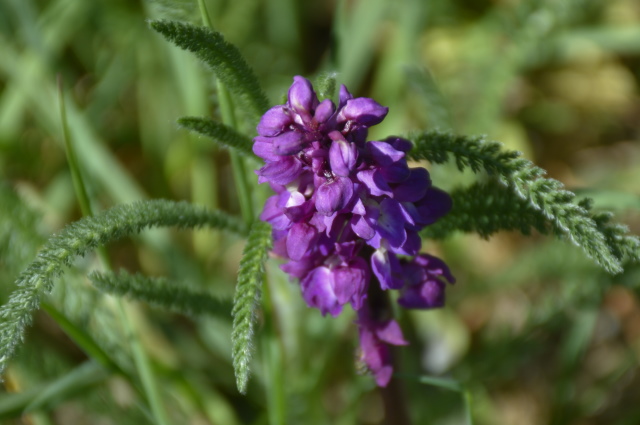
male orchis
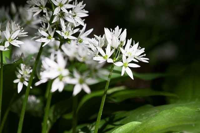
wild garlic
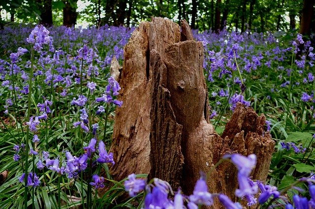
bluebells
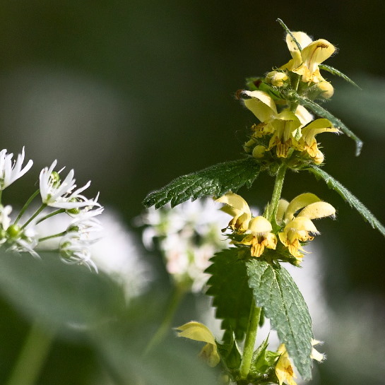
yellow dead-nettle
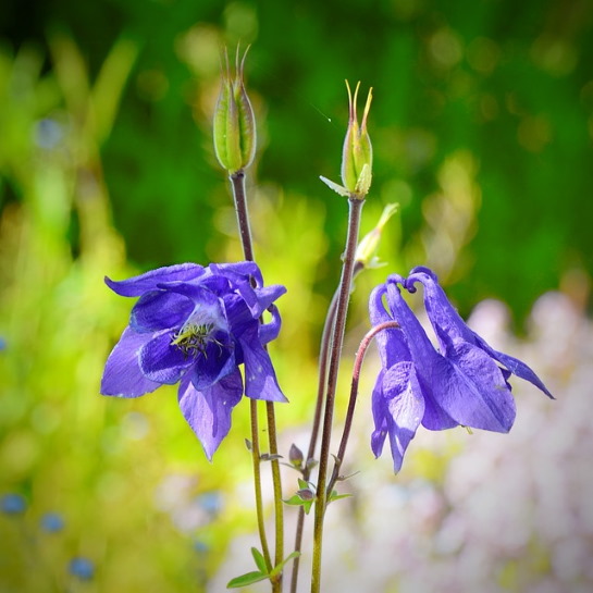
wild columbine
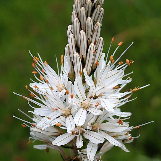
White asphodel
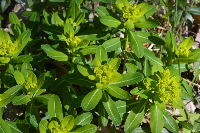
Irish Spurge
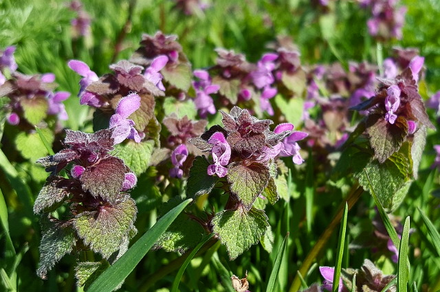
purple dead-nettle
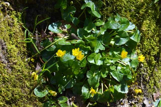
Lesser Celandine
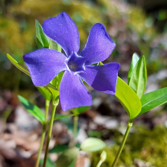
Greater Periwinkle
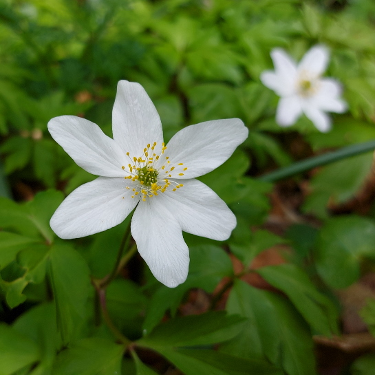
wood anemone
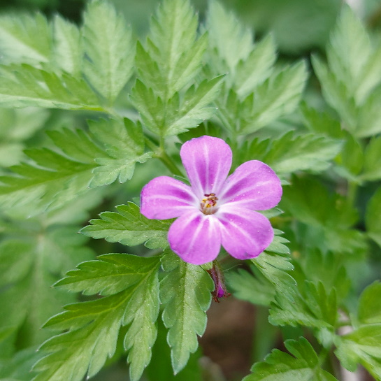
Geranium robertianum
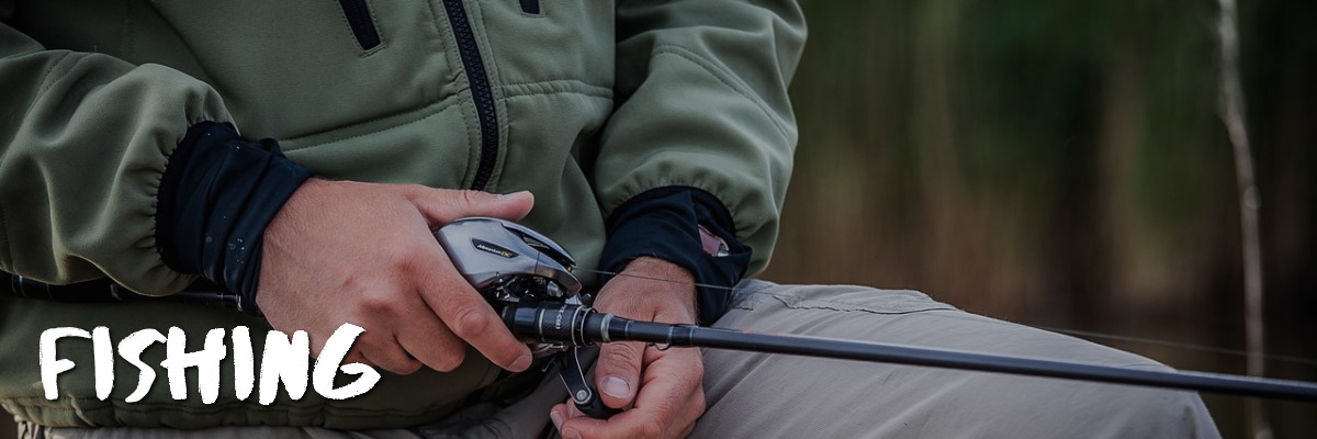
Daytime -and nighttime fishing –
Enthusiasts can fish for pike, eel, perch and roach from 3.2 km of shoreline, or by boat on the 128 ha lake.
Even nighttime carp fishing is possible and you will not find yourself alone under the stars. Night fishing is a popular local sport in the Massif-Forestier de Mervent-Vouvant.
A fishing dock and boat launch are accessible at Mervent, near the Valley Bridge outside the village.
All anglers must hold a valid, current fishing license. You can get them online here.
Boats can be rented for half a day or a full day.
Boat Rentals – Base de loisirs Mervent, 150, route touristique. 85200 Mervent
Telephone – (033) 02.51.00.22.13
Email – basedeloisirs@fontenayvendee.fr
Online reservations – here or here
Languages – French and English
Directions to boat launch and parking – enter your point of departure
GPS coordinates – 46.524238437083255, -0.7572130695686299
More fishing info on our website
Image - pixabay
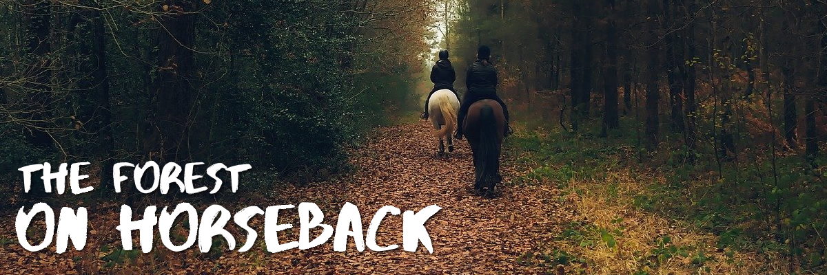
From easy to hard loops -
The Mervent-Vouvant forest features 150 km of marked equestrian paths between St Maurice des Noues and Fontenay le Comte offering a multitude of difficulty levels, geographical terrain and vistas that morph with the seasons.
The circuits in the forest massif are marked with a yellow horseshoe. DO bring a map. It's possible to cross other circuits and find yourself on another loop. Circuits may be shared with other visitors of the forest.
Local equestrian companies (e.g. Saint Maurice des Noues Ferme Equestre) offer excursions. Please contact them for schedules and more information.
Easy circuits include:
- Foussais Payre-La Grande Rhée (27km - easy) info, GPX & Maps
- Vouvant - Les Guillotières (17km - easy) info, GPX & maps
- Le Noyau (11.6km - easy) info, GPX & maps
- Pierre Brune (8km - easy) info, GPX & maps
Difficult circuits include:
- Mervent - Pont de la Vallée (24km - difficult) info, GPX & Maps
- Le Moulin Neuf (9.1km - difficult) info, GPX & maps
- Les Verreries (7.2km - difficult) info, GPX & maps
- La Mélusine (6.6km - difficult) info, GPS & maps
Open – Open all year
Parkings – Please consult included links for nearby parkings
Image – pixabay
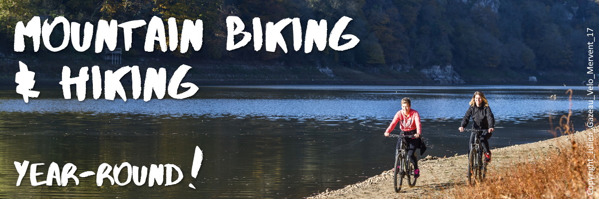
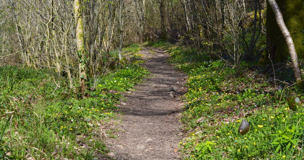
Breathtaking tranquility
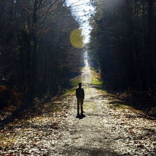
The Vendée's largest forest offers an array of activities, but the most popular among locals are probably hiking and mountain biking. Year-round, the forest is a peaceful haven, a protected nature reserve that shines its enchanted spirit everywhere you cast your eyes.
From naked trees in the winter, to their chartreuse awakening, from the birth of wildflowers in spring, to welcome shade in the summer heat, and a breathtaking pallet of fall colours...
... the forest never fails to cast a magic spell and you will find yourself wondering if the Fairy Mélusine still breathes among the trees?
Open – all year round
Link to hiking and mountain biking trails – in the forest (from easy to hard)
Address – 85200 Mervent
Popular walk (easy) – Le Petit Maillezais 5km around the lake, a walk of approximately 1h45m
Picnic areas – there are 63+ picnic aread in and around the forest. Here is a list
Images – by inthevendee.com except intro image courtesy of Vendée Expansion/ Julien Gazeau
SPRING FLOWERS NEAR PONT DE DELUGE
WINTER IN THE FOREST
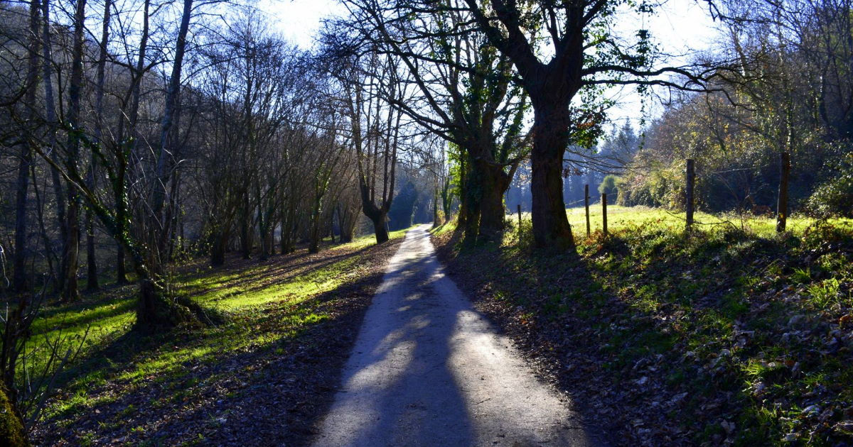
LONG SHADOWS IN THE FOREST
LE PETIT MAILLEZAIS TRAIL FROM CASTLE (spring)
AUTUMN IN THE FOREST
TRAILS ARE MARKED
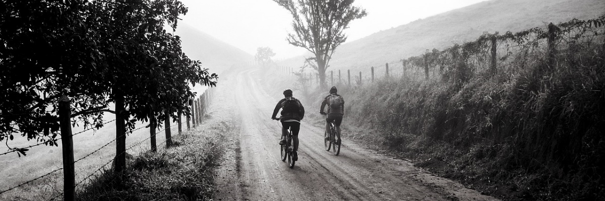
MOUNTAIN BIKING ALL YEAR ROUND IN THE MERVENT FOREST
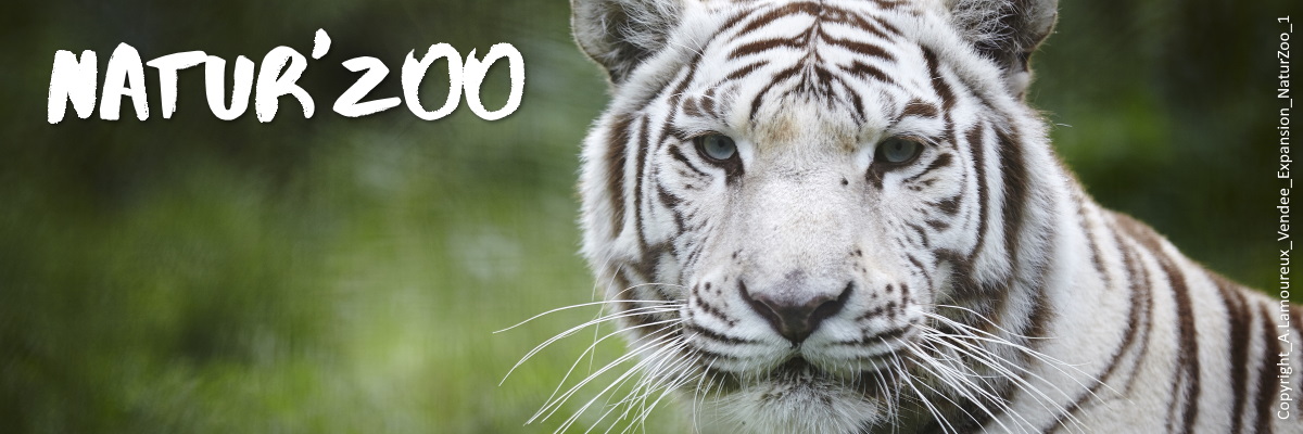
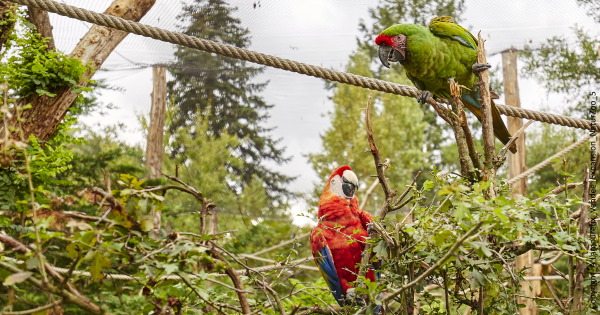
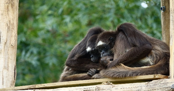
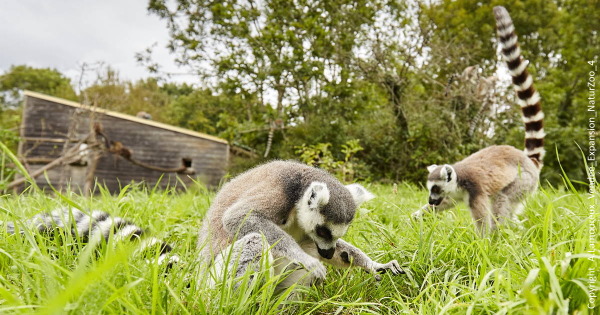
Natur'Zoo de Mervent Animal Park
Natur'Zoo is an animal park ideal for a leisurely family outing in the Mervent-Vouvant forest.
The zoo features over 300 animals of the bird, reptile, mammal variety including lions from Angola, meerkats and, in a nutshell, 60 species from all five continents.
The zoo is involved in conservation and environmental projects at European level.
Included in the price of your ticket from April to September, on weekends, public holidays and every day during school vacations (depending on zone and weather), are the interactions between caretakers and animals during feeing time. For the little ones there is a mini petting farm with goats, donkeys, chickens, alpacas and guinea pigs. There is also a playground with a monkey bridge, a zip line, slides and swings.
Special program for junior caretakers from 10 to 14yrs old. Activities include the preparation of food for the animals, feeding and preparation of enrichment games for the animals, and a visit behind the scenes.
There is an extra cost for this and with limited places reservations are necessary. Practical information here. You can register your child for the 2021 season via email contact@naturzoomervent.com.
Open – schedule
Tip – Follow the zoo on social media Facebook or Twitter to keep up to date with announcements
Address – Le Gros Roc, 85200 Mervent
GPS coordinates – 46° 30′ 40″ N, 0° 44′ 46″ W
Directions - enter your starting location
Website – here
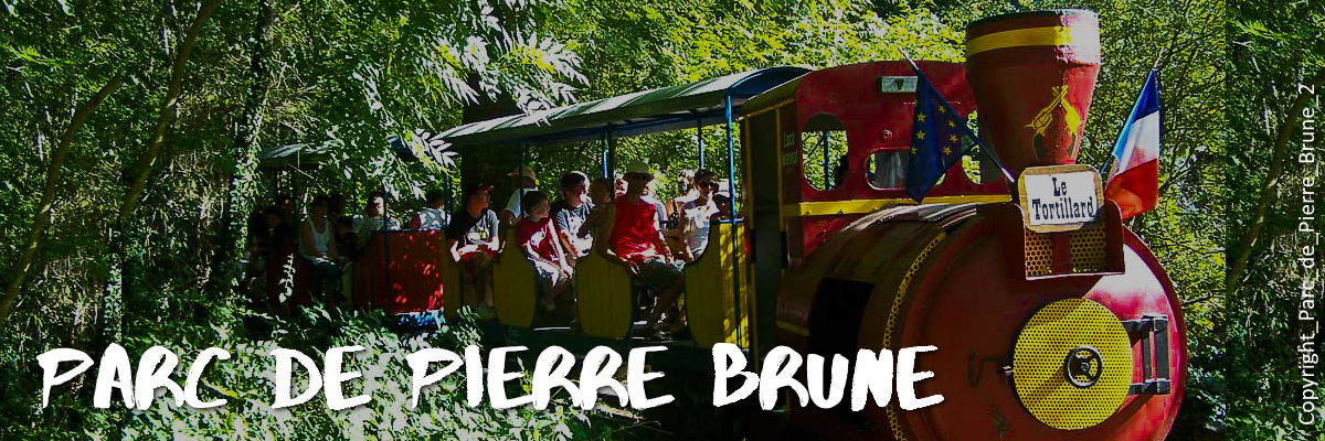
Pierre-Brune amusement park
In the heart of the Mervent Forest lies a 12-acre recreational area.
Don't expect hair raising roller coasters here! Instead the park invites to a day of good old-fashioned amusement park fun the whole family can enjoy.
It is centered around a little train which has choo-chooed many families around since 1959.
Enjoy the trampolines, merry-go-round, a zipline, bungee jump, bumper boats, mini-golf course, and a new toboggan of some 50 meters, 6 bumps and 4 lanes! In short, including this is a fun park featuring over 40 different games and animations to delight children, parents and grandparents, in the natural setting of a densely wooded forest.
There is also a mini-park for the littlest guests to enjoy.
Lunch can be purchased at the Snack-Bar du Voltigeur. Options include steak-frites, grilled sandwiches, homemade burgers, pancakes, waffles, sundaes and drinks. Picnics can be enjoyed at Café de la Grotte at the entrance to the Park.
Open – schedule
Follow the park on Facebook and Instagram social media to be kept informed
Tip – Cyclists are welcome to stop by Café de la Grotte. Bike racks and repair kits are available.
Address – Lieu-dit Pierre Brune, 85200 Mervent
GPS coordinates – 47°10′53″N 0°03′06″E
Directions to the park – enter your starting location
Website – here
Worth a look
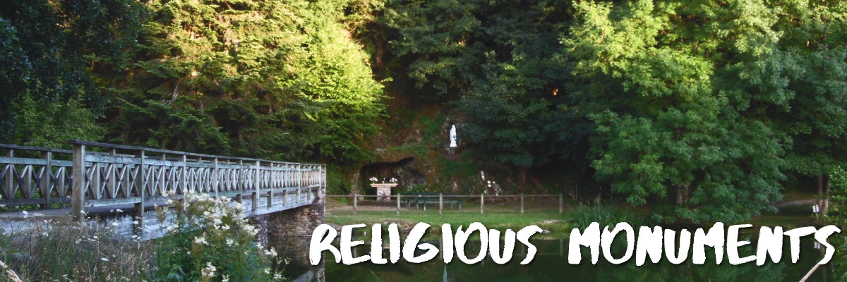
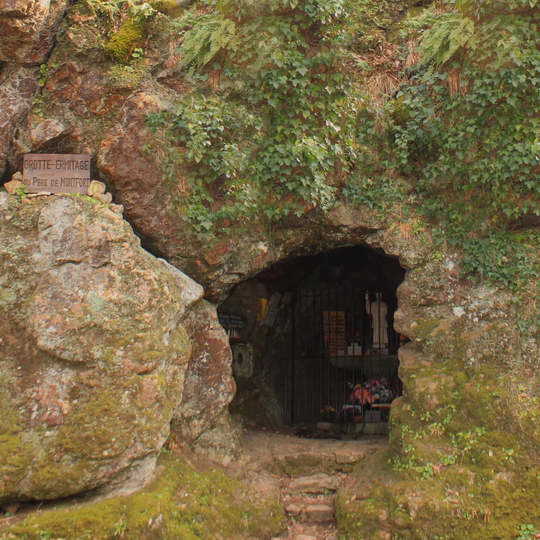
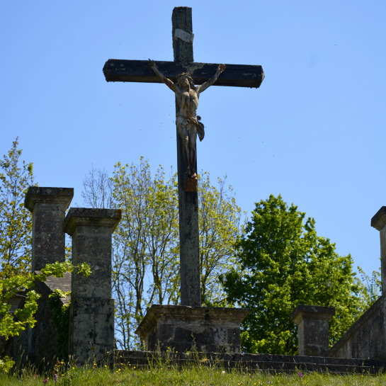
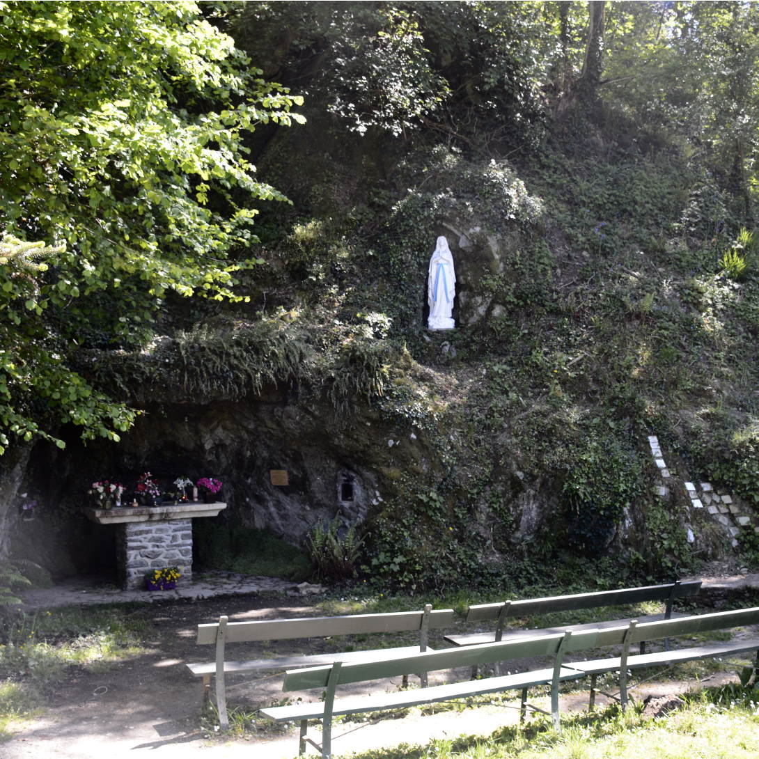
Throughout the forest there are several religious monuments and places of pilgrimage. The most important is the Grotto of Père de Montfort, a humble missionary preacher born on January 23, 1673 in Brittany. who notably retreated to the grotto in solitude and prayer in June, September and October 1718. Unfortunately, he was forced to leave because he had cut down some trees in the royal forest without asking for permission.
Père de Montfort died of pleurisy in Saint-Laurent-sur-Sèvre, a village known as 'the holy city' north in the department, where he was buried. Upon his death, the grotto in the Mervent forest became a popular pilgrimage where mass is still held on occasion.
Louis-Marie Grignion de Montfort was canonized in 1947, becoming a patron saint of preachers.
In addition to the grotto, there is a statue, a cavalry and a chapel dedicated to him in the forest.
Open – Year-round
Tip – you can park nearby, then navigate a set of steep stairs set in hillside down to the grotto.
Trail loop – moderate difficulty level, departs from Père Montfort Cave in a 10km loop. Info and map
Address – 85200 Mervent
Grotto GPS coordinates – 46.54273808716116, -0.781222092795896
Directions to Grotto – enter your starting point
Chapel GPS coordinates – 46.54306356992825, -0.7803321198499235
Directions to Chapel – enter your starting point
Calvaire (Vouvant) – GPS 46.57089651639524, -0.7652018945712643
Directions Calvaire (Vouvant) – enter your starting point
Related article – more about Father Montfort who was later elevated into sainthood
On the banks of the Mère river in Vouvant there is a replica of the Lourdes grotto with benches for quiet contemplation.
Grotte de Vouvant – 46.57013761212017, -0.7668216476078926
Directions Grotte de Vouvant – enter your starting point
Images – by inthevendee
the Grotto of pere de montfort
Cavalaire Pere de Montfort Vouvant
lourdes grotto (vouvant) 1958
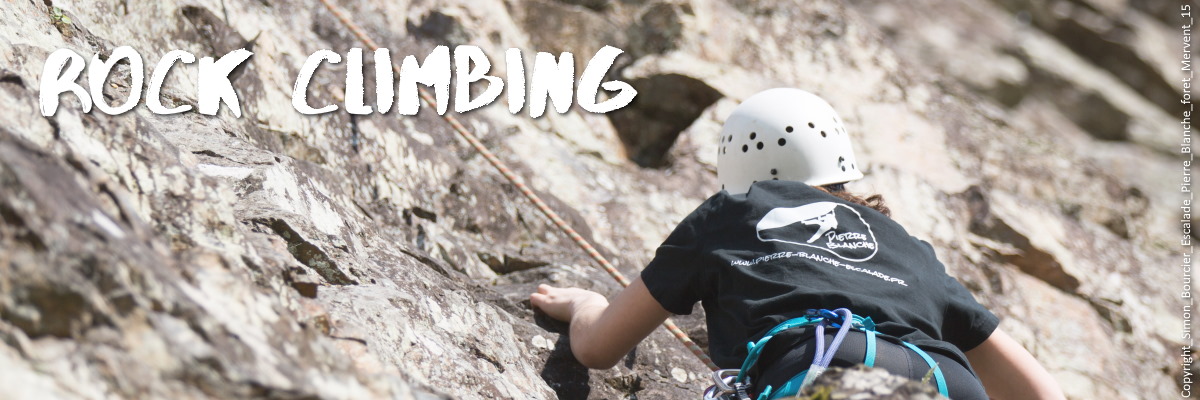
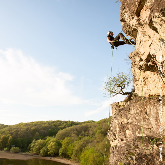
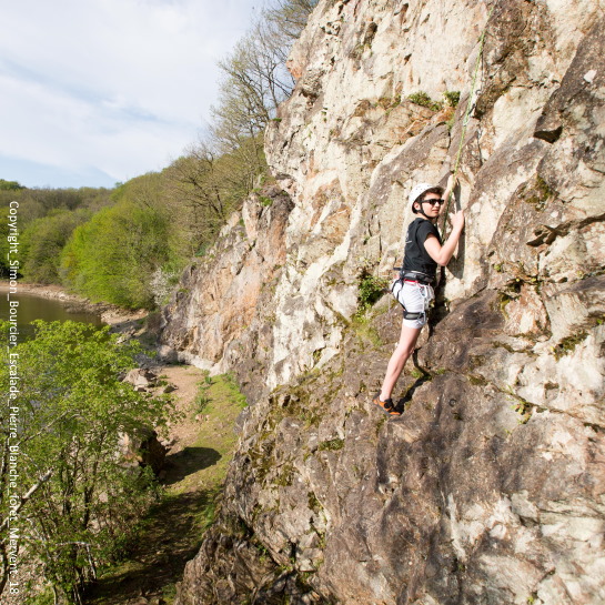
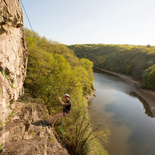
Vertical exploration -
Underneath the canopy of 30m oak trees the forest is enchanting but that vibe is penetrated by steep rock faces. The forest is located in the South Armorican Zone, part of the Armorican Massif consisting of a string of hills with granitoid rocks which can form in a tectonic environment. Yes, we do have earthquakes in the Vendée, albeit tiny tremors!
In the Mervent-Vouvant forest, the vertical rockfaces are ideal for rock-climbing.
Height – 40m
Open – year-round
Address – chemin de pierre blanche D99a 85200 MERVENT
GPS Coordinates – 46.54037638137914, -0.770221341866998
Directions – enter your location
Website – Pierre Blanche escalades
Contact – 02 51 44 27 22 or 06 50 08 70 32
Ask for more info at Base de Loisirs:
Telephone – (033) 02.51.00.22.13
Email – basedeloisirs@fontenayvendee.fr
Directions – enter your point of departure
GPS coordinates – 46.524238437083255, -0.7572130695686299
Images – by courtesy of Vendée Expansion Image library
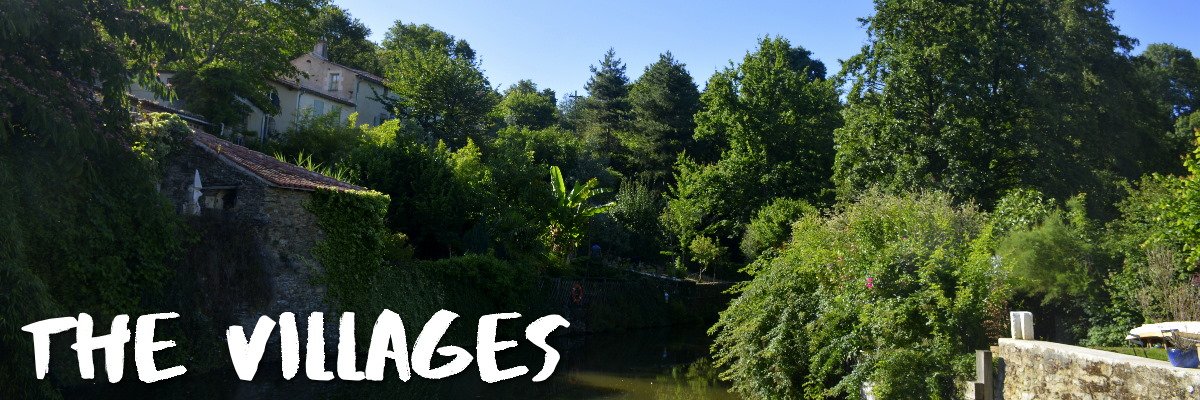
Vouvant, a top destination in France
Resting snugly in the arms of the Mère river at the edge of La forêt de Mervent-Vouvant lies one of France's most beautiful villages. Its narrow streets demand a stroll to admire a colorful plethora of flowers that seem to burst from every crack in the pavement, and the 1000-year old architecture including the intact walls and towers of the city.
Vouvant is a village that seems to have been kissed by the gentle lips of history and tended by the loving care of faeries. Accept the challenge of discovery and you will quickly understand why it is inspiring to so many artists and is lovingly referred to as le village des peintres (our article to the painter's village).
Open – always open for a walkabout
Tip – many artists and art galleries; as well as the Eco-museum of the Maison des Amis de la Forêt an interesting museum near the old bridge featuring tools and art that has been in use by the same family for several generations.
Address – 85120 Vouvant
GPS coordinates – 46° 34′ 20″ N, 0° 46′ 11″ W
Directions – enter your starting location
Images – inthevendee.com
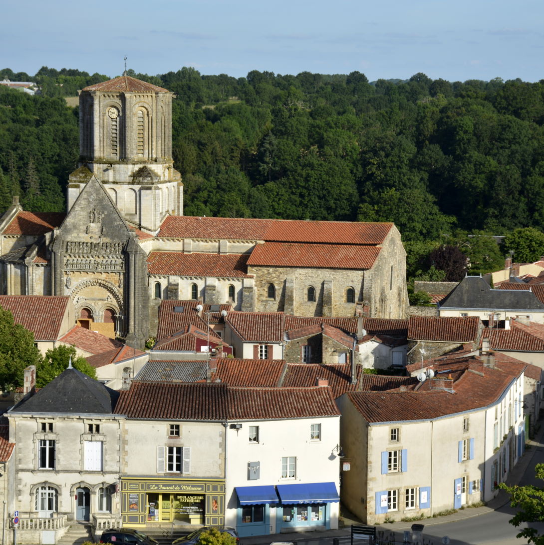
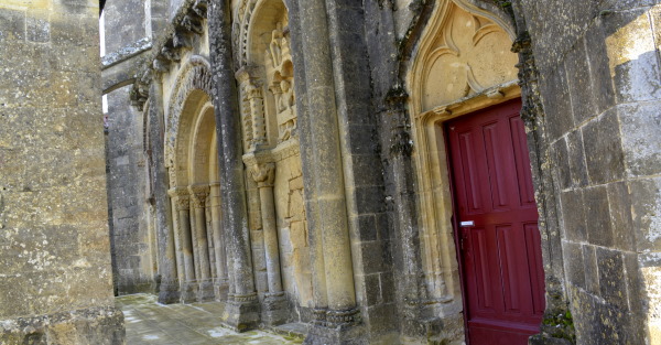
Foussais-Payré, XIIIth century church façade
This quaint village was established in the Gallo-Roman period. There are several historical buildings to admire here but none so lovely as the church and fortified prieuré (currently the town hall). Both church and priory were established in the XIth century but saw much destruction and restoration in consequent periods. The church portal is nothing short of stunning even if some statues and carvings were decapitated during the 16th century Wars of Religion.
During the Renaissance, the village of Foussais was quite prosperous. In addition to being an agricultural area, there were spinning mills and tanneries, and a number of weavers. These businesses exported their goods to Holland and to Germany.
Open – always open for a walkabout
Not to miss – artisan chocolatier whose products will have you swoon! They also offer workshops
Tip – annual week-long chainsaw sculpting festival and contest (highly recommended!)
Address – 85240 Foussais-Payré
GPS coordinates – 46° 31′ 52″ N, 0° 40′ 58″ W
Directions– enter your starting location
Nearby sightseeing – historic lime ovens located just outside the village (private property but you can see them)
Images – inthevendee.com
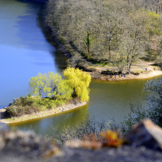
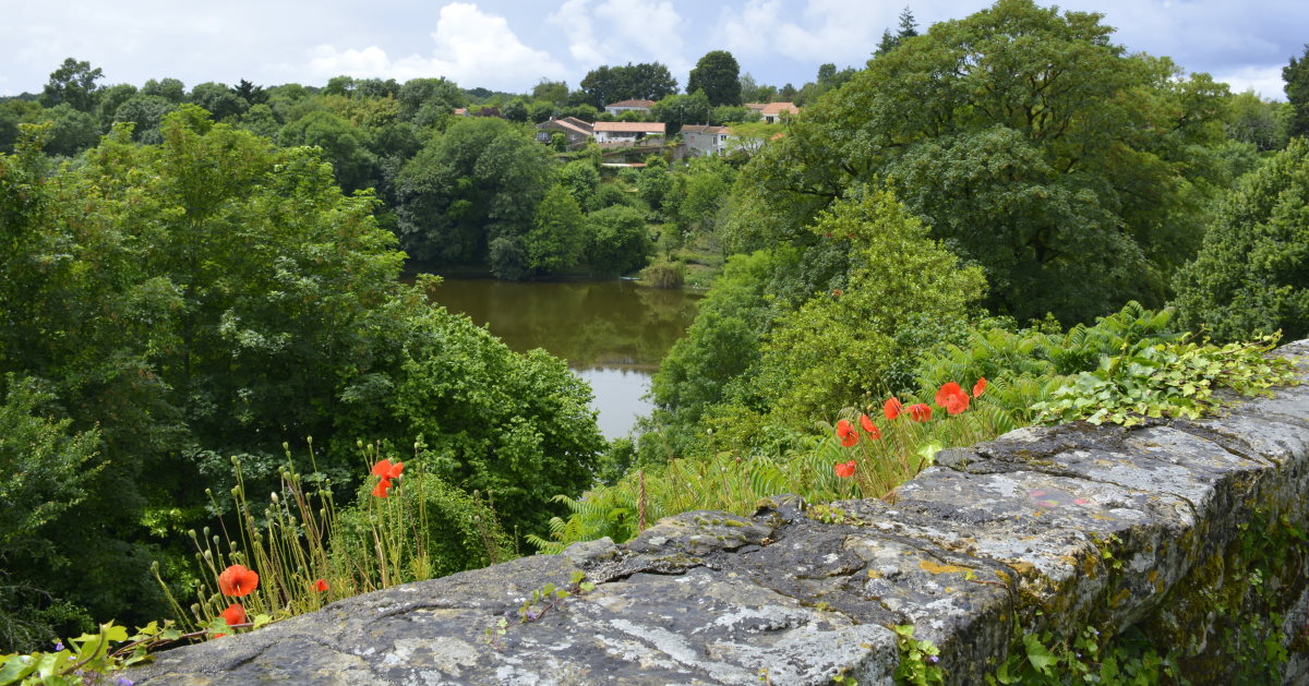
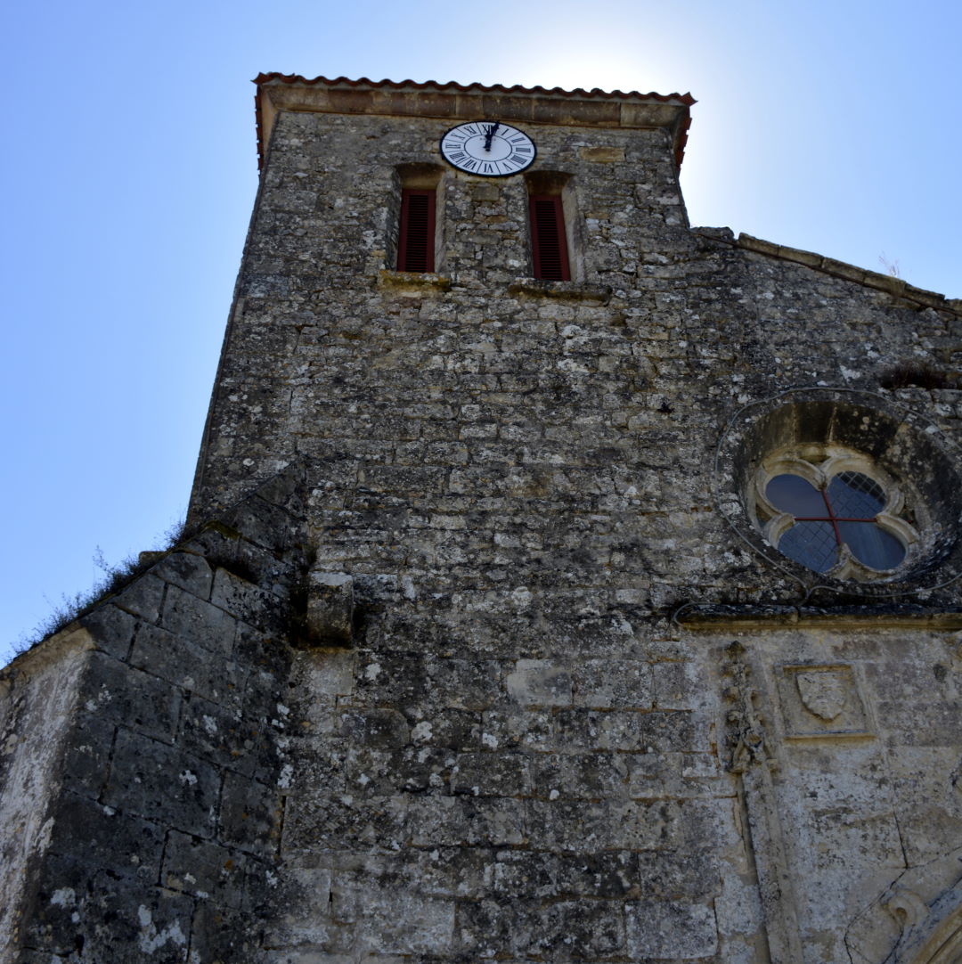
Mervent, stunning views of the forest, lake and rivers
in the heart of the forest lies the village that bears the same name. Witness the beauty of the forest and the lake at different locations around the village above. It is possible to rent pedalo (paddle boats) at the lake shore (e.g. from one of the restaurants there.)
The Saint-Médard church is quite old and remarkable. The Nave with its two windows are part of the original Xth century church, and the Lords of Mervent castle (ruins behind the town hall) had the choir added in the XIVth and XVth centuries. Admire the clock mechanism, anno 1640, and still working. There is a stone font and beautiful stained-glass windows.
Open – always open for a walkabout
Tip – stunning views over the forest and river. Small grocery store in the village square.
Address – 85200 Mervent
GPS coordinates – 46° 31′ 23″ N, 0° 45′ 19″ W
Directions–enter your starting location
Nearby sightseeing – Vouvant
Images – inthevendee.com
Vouvant
Foussais-Payré
Mervent
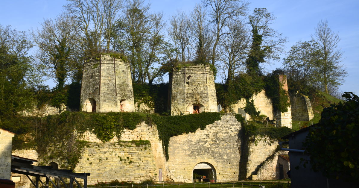
Historic Lime Ovens in Foussais-Payré
The lung of the Vendée
Without a doubt the forest of Mervent-Vouvant with its running brooks, majestic hardwood trees, historic monuments, and adventure spots is one of the most timeless areas to discover in the Vendée.
Amateur photographers, sports enthusiasts or novices, solo travelers, couples, groups and families will find all they need for a memorable time in the Vendée in every season. Particularly in winter, the forest trails are perfect for hiking and mountain biking, as well as horseback riding. For these activities it is important to bring a map (or GPX) and water. Maps are available at the Tourist Offices or online.
Planning ahead: the winding roads of the forest are sometimes quite steep but they are well-paved which makes navigating cars, bicycles etc between the interesting features the forest has to offer quite easy. You will have to set foot in the forest for spot-sightseeing e.g. to see the oldest and most remarkable trees, so it is important to wear good shoes.
Noteworthy spots are well marked with road signs and ample parking space is provided along the way. The small car park atop the Grotto of Père de Montfort is a popular spot for camper vans. Keep in mind that open fires are not allowed.
In addition to dozens of picnic areas, there are several restaurants and/ or places to enjoy an ice cream or crêpe are located in Mervent and Vouvant villages (and a couple in the forest). There is also a very good and very popular bakery in the forest where you can enjoy a coffee and treat on the terrace. Find a list here.
The Massif Forestier de Mervent-Vouvant is truly magical in every season! We hope you will enjoy it like the locals do!
Note: the popular pedagogic farm and camping is [temporarily] closed due to retirement. Hopefully new owners will be found. You might also find reference to a treetop adventure park, but it is sadly no longer there.
Share this Post