LIVING, Recipes, baking-in-france, baking-in-the-vendee, bread and hot chocolate, bread. home-made bread, European style milk bread ingredients, home made bread, homemade bread, how do I make bread, how to bake bread, how to bake brioche style bread, I-love-baking, is milk bread just brioche, milk bread, why is milk bread so good, wintery bread
Hidden Corners in the Vendée
Driving through endless farm fields across the rolling hills of the Vendée, adorable villages present themselves from a distance with ancient church steeples peeking over trees or clay rooftops. Why not slow down time itself to discover their hidden secrets? At inthevendee.com we swear by this method of travel. It's a great way to explore in all tranquility and occasionally meet likeminded people for a chat on the unbeaten paths of France.
Prehistoric and Romanesque –
How much do you really love history? Or adventure? Enough to ignore the incessant 'recalculating' voice of the GPS and point the nose of the car toward the slightest hint there may be something unique or interesting to see?
The hand of History –
Have you ever heard about the age-old tradition of gathering to wash laundry in a village pond still being honored? Or discovered a centuries-old chapel in a picturesque valley? Have you ever touched a circa 4000BC Megalith? Or explored manmade underground dwellings?
Travel local and explore more –
The Vendée certainly has its big sightseeing draws and each of them is worth your time. But don't underestimate the hidden things, the historical monuments with a sign pointing towards a farm field or something handwritten on a homemade wooden arrow.
1000 years underground
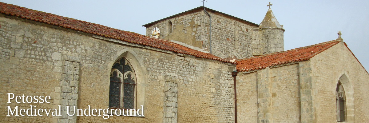
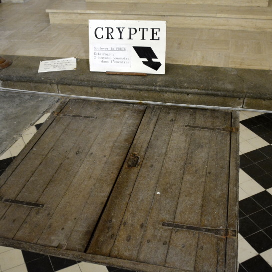
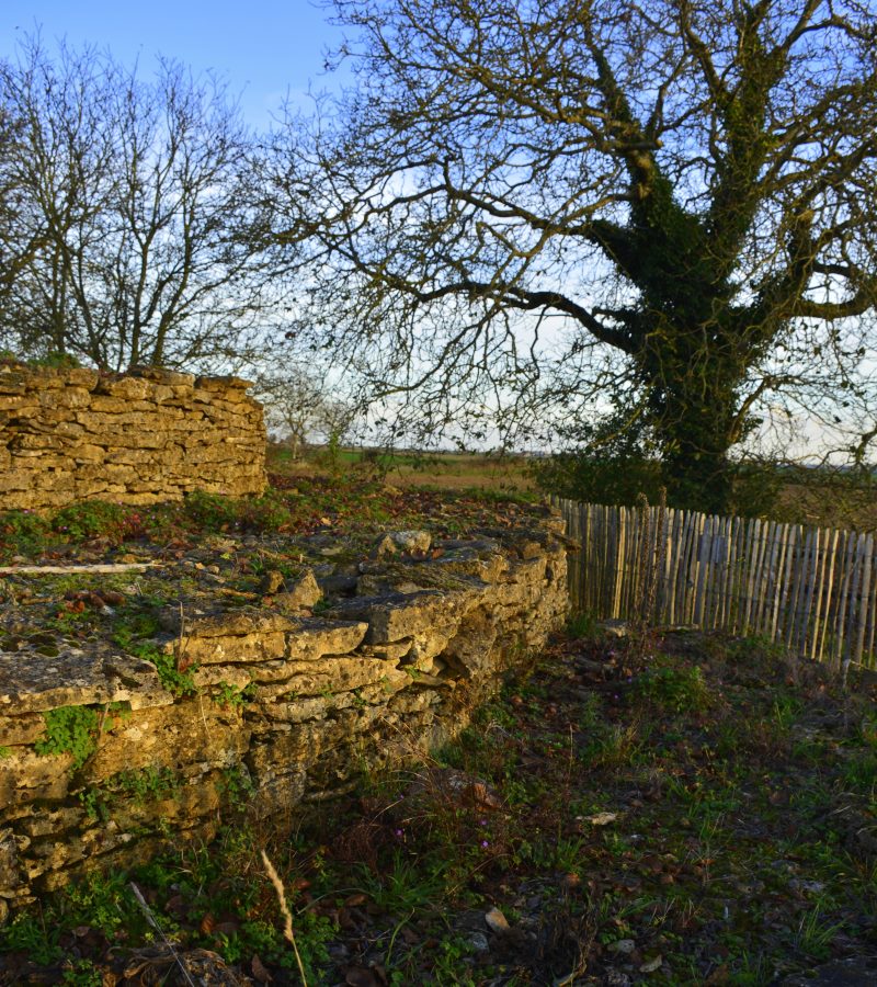
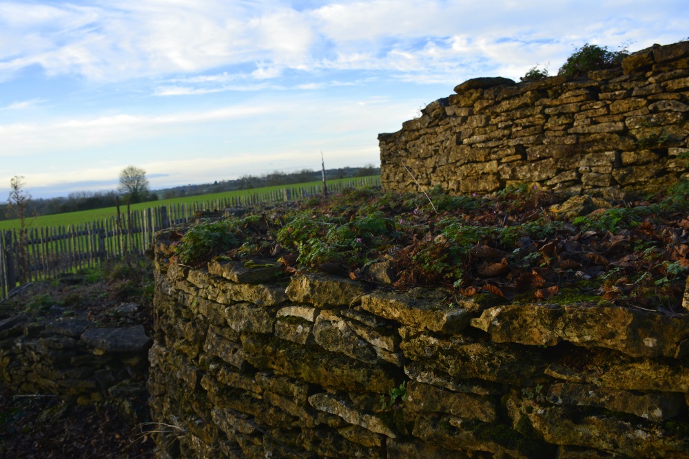
You wouldn't know it by driving through Petosse, a sleepy village of less than 600 inhabitants, but through a little door somewhere near the 11th century Saint-Julien Church lies a centuries-old staircase that leads to a piece of unusual culture.
At the bottom of these steps lies one of the best preserved underground shelters in France, a unique showpiece of the Middle Ages in the Vendée. These galleries and chambers were created through mining limestone for building purposes (such as the church above) and were very cleverly used both as a place of refuge and a form of defense in times of war.
One would crawl on all fours through holes in the thick walls from one room to another. As only one person at a time could get through, the person standing guard easily had the opportunity to knock any enemies who dared to enter the shelters, over the head.
It is not unheard of in the Vendée for humans and animals to seek shelter underground and in the rocks, but we assume that they did not bring cows here.
Open – Journées Patrimoine third weekend in September. It may be possible to arrange a tour from April through October. Tel town hall 02 51 00 14 11
Tip – The ceilings are not high, so you have to bend down when you visit. Tall people get a helmet, but you can also be prepared by bringing your own. Wear clothes and footwear appropriate for a humid environment of 14c, through which a couple of times you must also pass on all fours. A torch is also needed.
Address – 85570 Petosse
GPS coordinates – 46° 28′ 53″ N, 0° 54′ 29″ W
Nearby sightseeing - Fontenay le Comte and L'Hermenault
Images – by Spouik
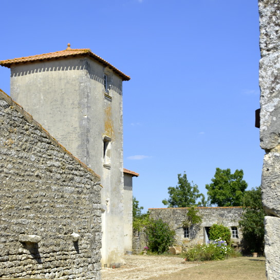
Historic manor house
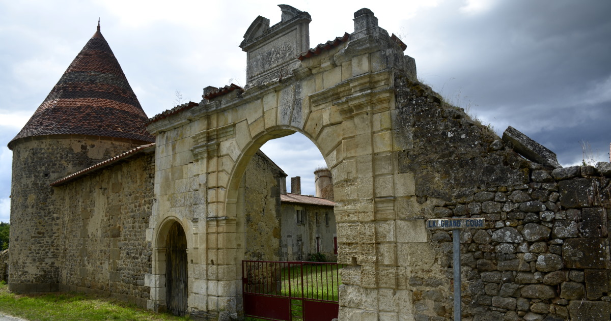
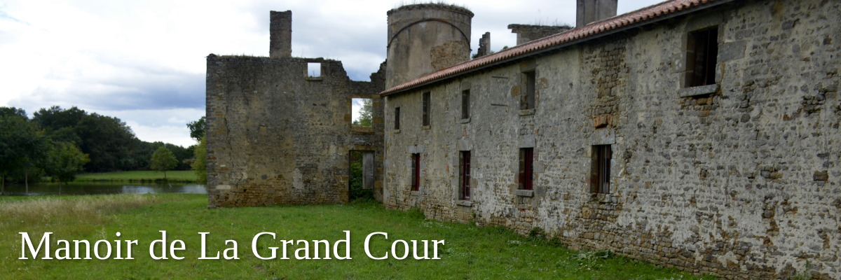
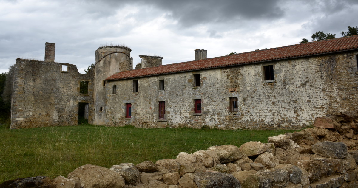
Slightly hidden in a side street and east of l'Hermenault (known for Chateau de l'Hermenault) is a manor house that surely captures the imagination. Built between the 15th and 17th centuries, this is one of the most complete examples of a gentleman's farm in the Poitou. Note the beautiful entrance gate from the 17th century (anno 1660) typical of the architecture of the time.
The park also features a huge pond and is just beautiful.
The estate was bought in 1640 by Mathurin Priouzeau, citizen of Fontenay-le-Comte, who carried out important works to the farm between 1660 and 1665. Until the French Revolution it was occupied by the Moreau des Moulières family.
Despite the fact that the municipality bought the estate and saved it from certain death with the help of Conseil Général of the Vendée, much of the estate still lies in ruins. In 2018 it was bought by a lady from Fontenay-le-Comte who spent part of her childhood here. The real restoration works on this historic farm are now well underway. Follow it all on Instagram and have a look from the street. Beautiful!
Open – Park nearby, you can easily admire and photograph it from the street
Festival – Hopefully the festival Le Rêve du Lac will be organized again in the near future.
Instagram – Follow the massive restoration project on social media
Tip – geocache
Address – Les Mouillieres, 85570 l'Hermenault
GPS coordinates – 46.51976524791288, -0.8838333304074892
Nearby sightseeing – l'Hermenault dorp met zijn oude lavoir, en zijn verschillende kastelen (privé) zoals Chateau de l'Hermenault
Images – by inthevendee
The old island
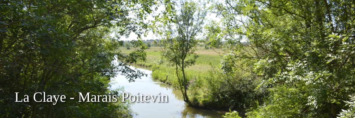
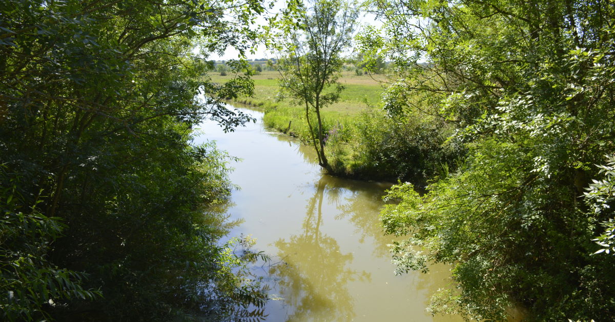
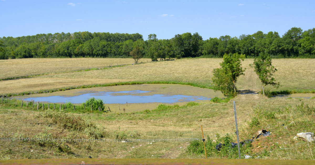
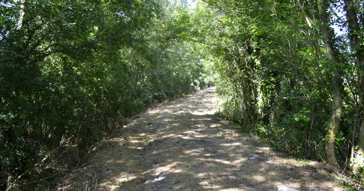
This walking circuit of 13km or 8mi begins and ends in La Bretonnière-la Claye, follows the circumference of what was an island in the Gulf of Pictons around 10,000 years ago.
Beginning in the Xth century, monks from nearby (and then coastal) abbeys began to transform the gulf into a varied landscape of marshland.
The marriage of time-deposited sediments, and arduous manual labor by the monks form the large expanse that is called the Marais Poitevin today.
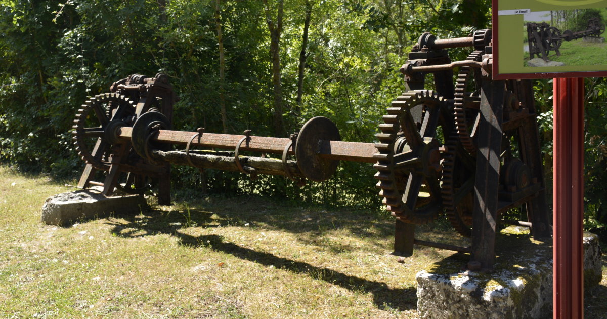
On this easy walk between the cultivated farmland and lovely green meadows, enjoy the wide horizon of the Lay and Yon river valleys with its bridges and age-old sluices, hydraulic systems, and dikes that regulate the water levels in the marshes.
Open – all year
Tip – tranquil fishing and picnic area at the start of the trail. Bring water (no shops in the village) and supplies needed for the hike.
Address – 85320 La Claye
GPS coordinates – 46° 28′ 44″ N, 1° 17′ 03″ W
Nearby Sightseeing – Church Église Saint-Hilaire, La Crypte de Curzon - where there is also canoeing and touring of the Marais by boat.
Dog walking – superb
Images – by inthevendee.com
Sinister history
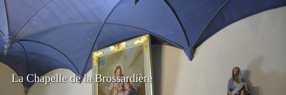
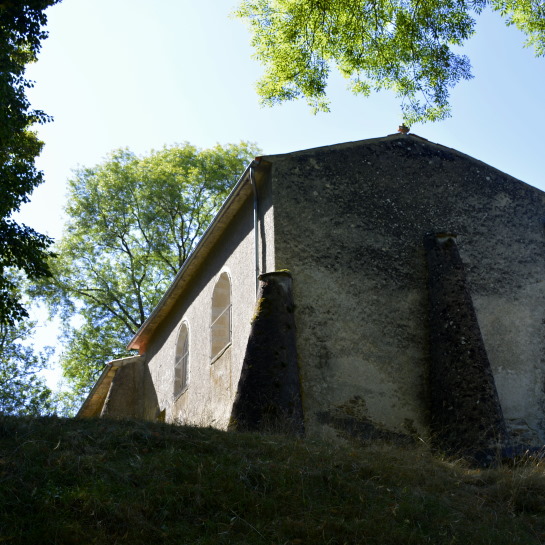
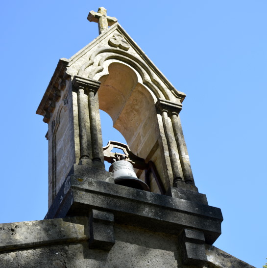
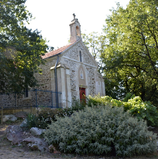
Literally off the beaten path in an idyllic little valley just outside the village of La Tardière, lies a small chapel called Our Lady of Brossardière. The chapel has a sinister origin: on August 3rd 1595-near the end of the Wars of Religion- 31 protestants were massacred in a barn-cum-temple at this location.
Built in dedication to Our Lady of Recouvrance, this small chapel becomes a well-attended pilgrimage site on August 15 (Ascension of Mary) each year and this in thanksgiving for recovery from illness.
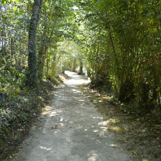
Additional parking is then provided in a nearby meadow and additional escorts are also provided. There is a nice path to the chapel which is very well maintained by the municipality, but the chapel is located a few meters high on a little hill which can be difficult especially with a wheelchair.
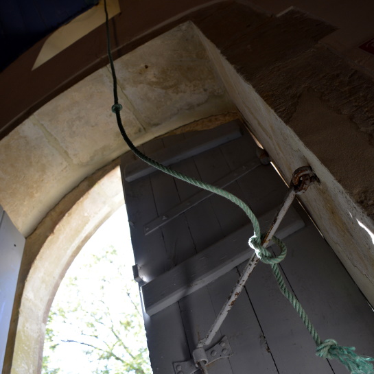
Throughout the year, when people visit, they often ring the chapel bell, a cozy sound that echoes through the green surroundings. Really worth a visit or a quiet reflection.
Open – Year-round
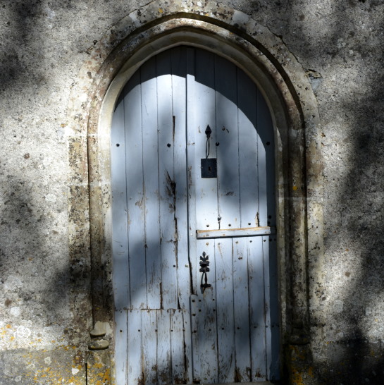
Tip – the chapel's location is marked right by the path that leads to it. (there's a big speedbump, can't miss it)
Address – La Brossardière, 85120 La Tardière
GPS coordinates – to the village
46°39′41″N 0°43′56″W
Nearby Sightseeing – Base de l'Etruyère (swimming, horse riding and other activities), Vouvant (medieval village)
Images – by inthevendee.com
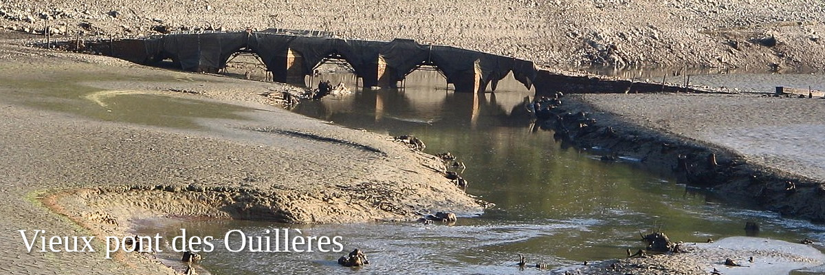
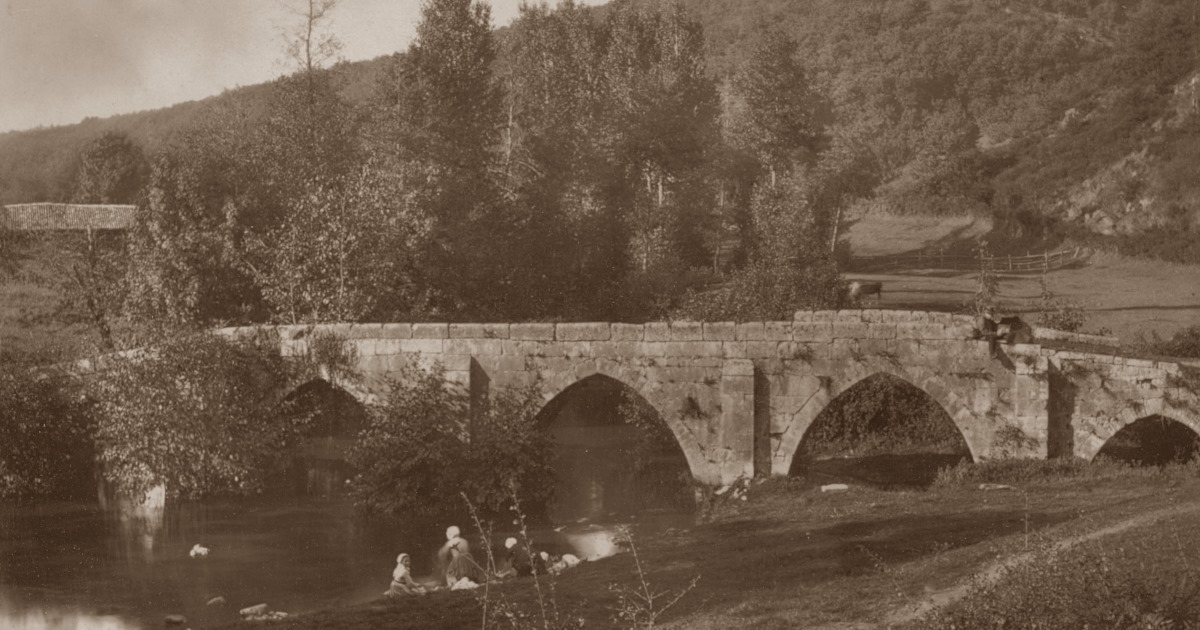
The Gothic ghost bridge
At one time, this bridge was the only access point to Mervent. It was built of stone from the local limestone quarries over a shallow point in the river Mère. Its distinctive appearance with the five arches, the parapet (balustrade) and the four "starlings" (wedge-shaped stone structure protecting the piers) on the bridge façade indicate that some parts of the bridge probably date from the 13th century and others from the 15th.
After the construction of the dam in 1956, which filled the reservoir to form a lake, this beautiful Gothic monument became completely submerged.
Attempts and requests to relocate it for its preservation are invariably rejected. Thus, the bridge becomes visible only when the reservoir is drained. Time and again, more of the stones of the Vieux pont des Ouillères lie broken on in the old riverbed.
A local legend tells that the devil, exhausted from a long journey, sat down on a stone downstream of the bridge and left his imprint.
Tip - Information shows that the draining of the lake takes place about every ten years, so the surfacing of the bridge draws large crowds, even of people who travel great distances to see this historical monument.
GPS coordinates - 46° 31′ 21″ N, 0° 44′ 54″ E
Image - by Jules Robuchon (late 19th century)
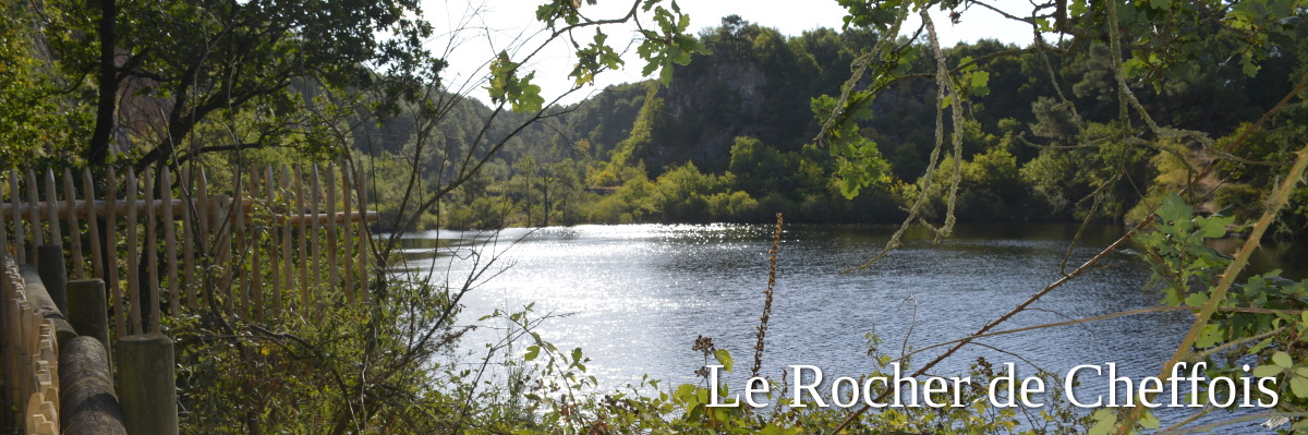
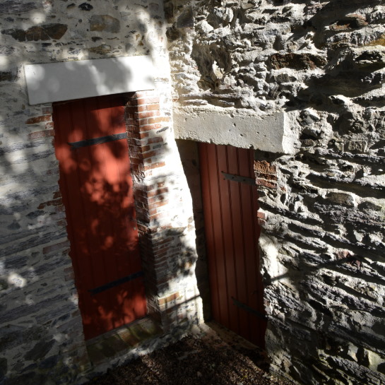
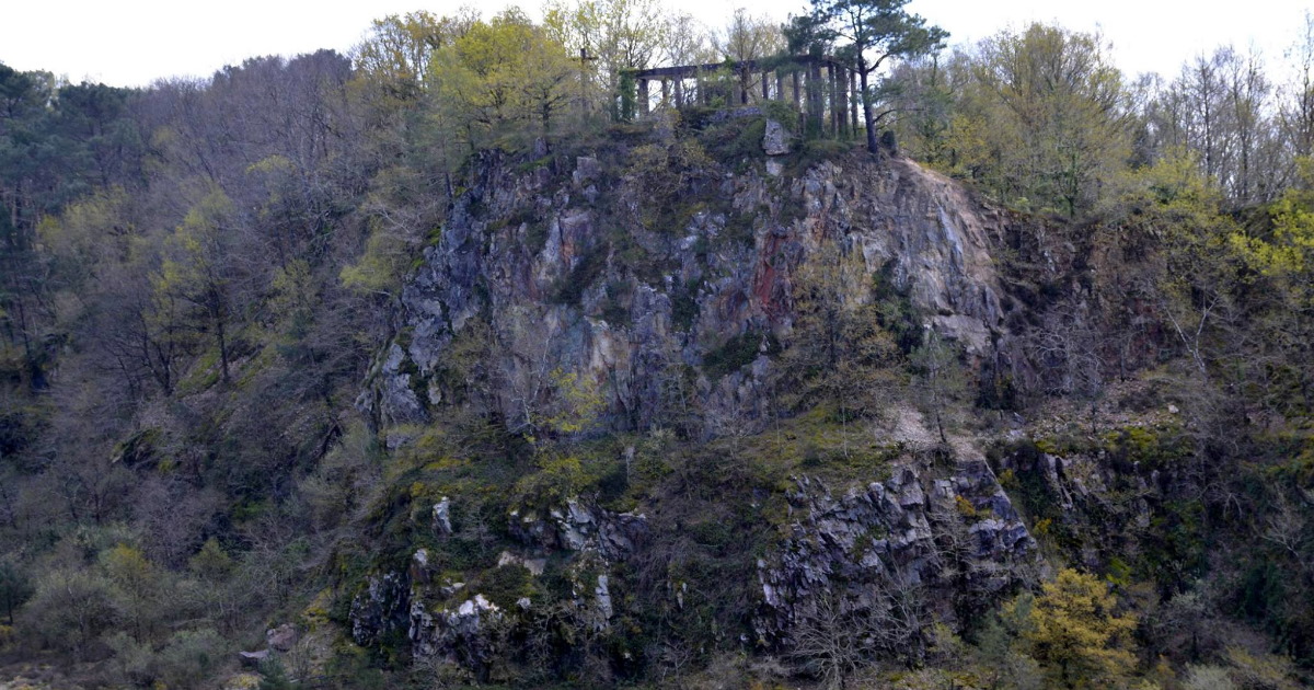
In centuries past, possibly since Celtic times, this location was referred to as 'the mountain', a place for religious and cultural practices or oppidum. But evidence shows that the in and around the minuscule village of Cheffois, located geographically between 'Haut' and 'Bas' Bocage (the higher and lower Vendée countryside) was already populated in pre-historic times.
The old stone quarry featured in this article is not only tucked away within its depths, it is a place of rich historic significance. Cheffois is named after Latin origin 'scava faya', meaning "hollow where the beech grows".
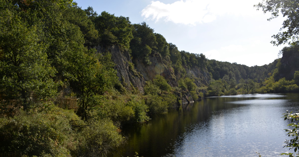
Beginning in 1903 a workforce of Czech, Italian, Polish, Russian and Spanish "jewelers" lived on-site, hewing quartzite from the rock by hand for roads and railways. The mine was closed in 1953 and since then the deep hole of the quarry has filled to become a lake that you can't see from anywhere except if you're standing right beside it, or hiking along one a wooded path atop the rocks surrounding it.
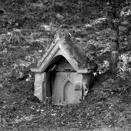
The little chapel-like structure at the foot of the hill (entry of hiking trails) is an ancient structure of great symbolism: the the Fountain of Fertility. The original chapel by the edge of the lake dates from 1863 but was removed ca. 1921. The current La Chapelle de la Montagne was restored by volunteers from the village between 2006- 2008.
An old mining structure left behind high atop the rock ridge has the air of a Roman pagoda or a Greek temple. The walking trails are extensive and sometimes strenuous, but at a height of nearly 199 meters, the panoramic vistas of countryside are beautiful and the water shimmering against the quartz rock walls in the depths of the quarry lend the place something quite magical.
Special measures are in place for its protection. It is home to both migrating bird species and those living here year-round like the Accipiter gentilis (Northern Goshawk, a nationally protected bird of prey); misc. dragonflies, butterflies and rare moths, grasshoppers and other insects; misc. bat species such as the Lesser Horseshoe bat, Greater Horseshoe bat, Whiskered bat and Natterer's bat; and misc. reptiles.
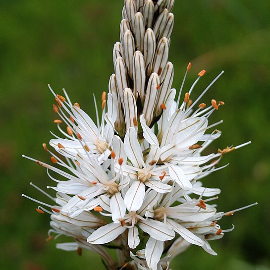
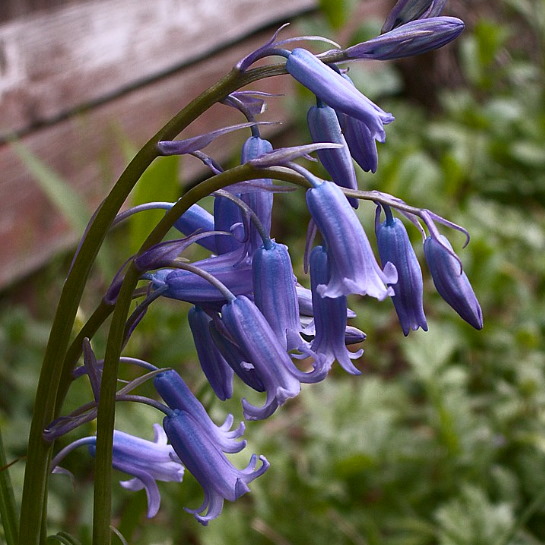
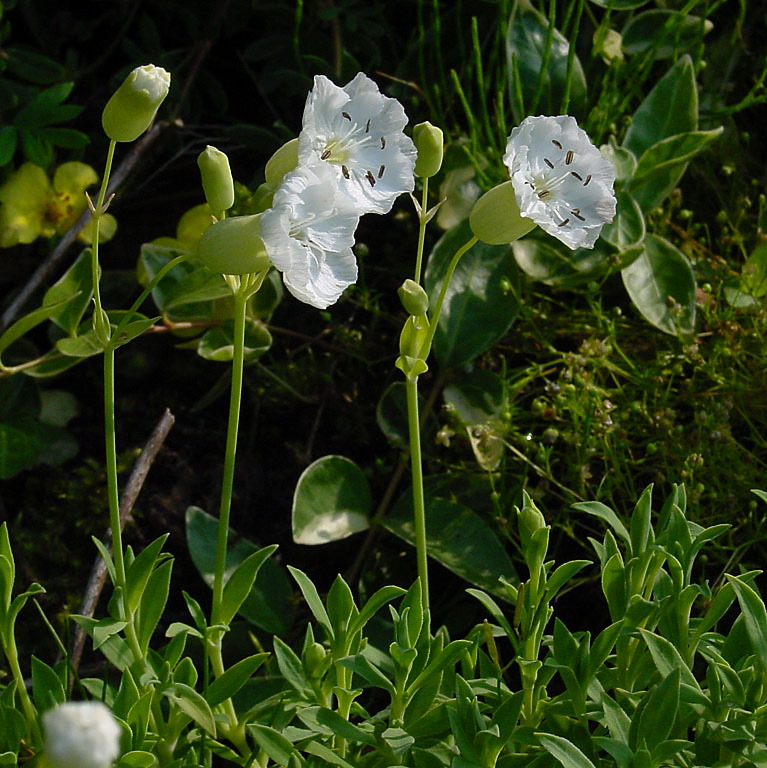
Wildflowers are numerous, including the Silene Uniflora (sea campion), white asphodel, bluebells and so much more.
This hidden spot contributes greatly to the geological and ecological biodiversity and heritage of the Vendée, making it a true hidden gem!
Open – all year
Tip – Swimming is strictly prohibited, as is the walking trail next to the lake. Fines are issued when caught. Keep children close when walking the trails atop the quarry lake. There are no barriers.
Address – 85390 Cheffois
GPS coordinates – 46°40′10″N 0°47′24″W
Nearby Sightseeing – Ripaud, a plant nursery spanning the hills between Mouilleron-en-Pareds, Cheffois and La Tardière, is mentioned in travel books as a great place for a walk- likened to a botanic garden. We think it might belong to the famed Dr. Suess or Alice in Wonderland. A Vendéen cycling path runs through it. Also on this road near La Tardière is the hidden valley and La Chapelle de la Brossardière mentioned in this article.
Dog walking – terrific (on a leash)
Images – by inthevendee.com
Tranquil slumber in the Vendeen countryside
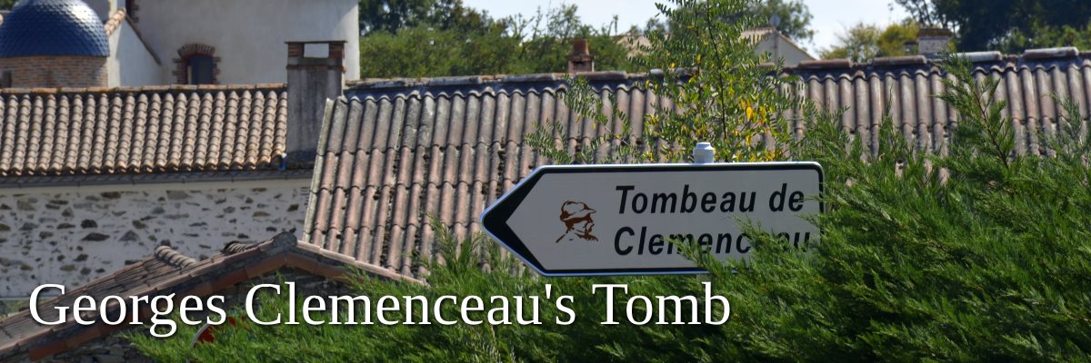
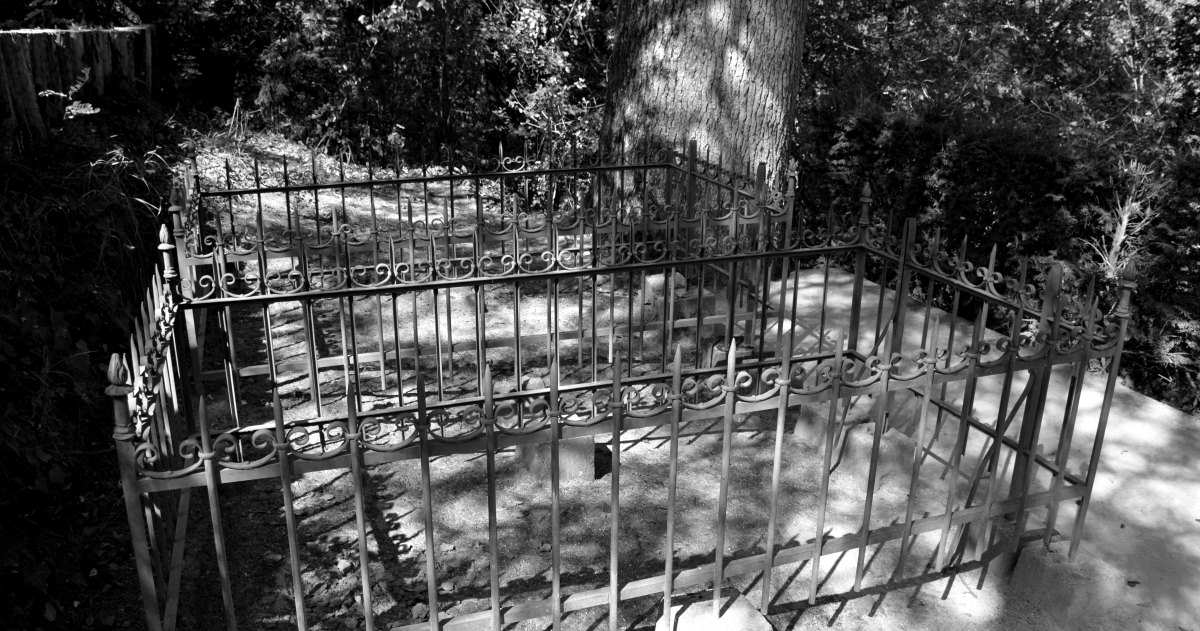
Georges Clemenceau died on November 24, 1929, aged 88, at home in Paris. In his will he stipulated to be buried "without procession or ceremony of any kind" next to his father at Le Colombier, the chateau where the Clemenceau family had settled since the end of the 17th century.
On November 25th Georges, President of France, was buried in Mouchamps. No amount of gendarmes could keep hundreds local farmers from attending the funeral.
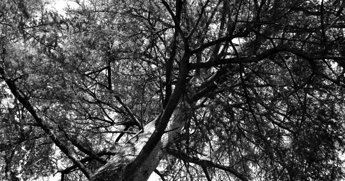
Father and son Clemenceau are buried side-by-side on a rocky ridge overlooking the valley of the Petit Lay river, beneath a beautiful cedar Atlas tree planted in 1848 by Benjamin Clemenceau.
A small buvette is located nearby. Stop in for a drink and a chat with the lady whose parents ran father Clemenceau's farm. She is a very lovely French lady who has cared for the burial site for many, many decades, and is happy to give you an impassioned account of Clemenceau's life. Including the fact that he was "naughty" with the ladies.
She is a humble farmer's daughter who by the sheer location of her birth and childhood has met her share of French presidents, including Emanuel Macron on June 13th, 2018.
Open – Gravesite always open. Parking nearby.
Tip – Don't miss an opportunity to chat with the caretaker, though in French only.
Address – Le Colombier, Mouchamps
GPS coordinates – 46° 47′ 36″ N, 1° 00′ 59″ O
Nearby Sightseeing – Mouchamps is a lovely little village
Park Chateau de Terre-Neuve – superb walking and picnic spots
Images – by inthevendee
Hidden in obscurity
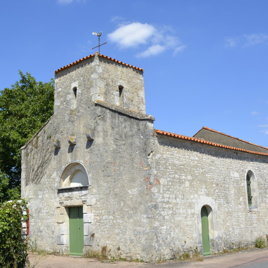
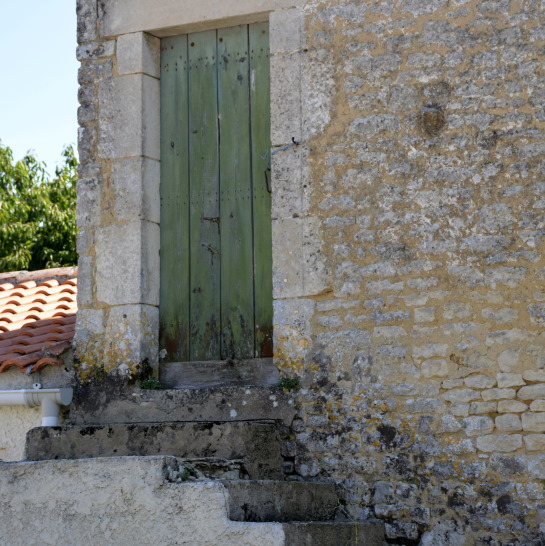
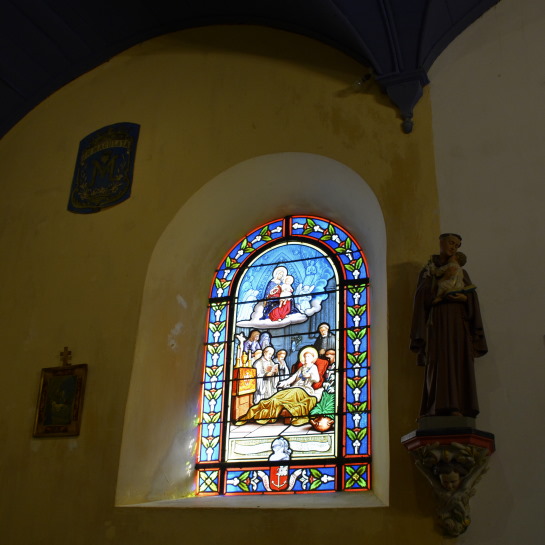
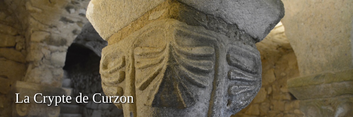
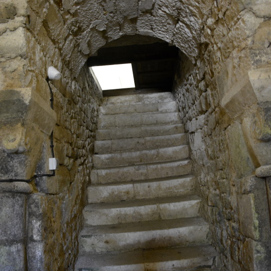
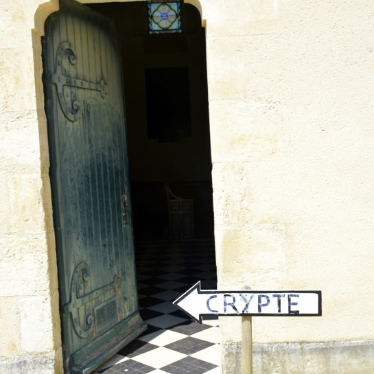
There is nothing like bursting over, through, or under walls and doors to ignited a sense of adventure and this spot does just that. Hidden beneath a church 'like so many others' (anno 1873) - the Eglise de Curzon - it might be easy to ignore the signposts to this historic gem. Don't ignore them!
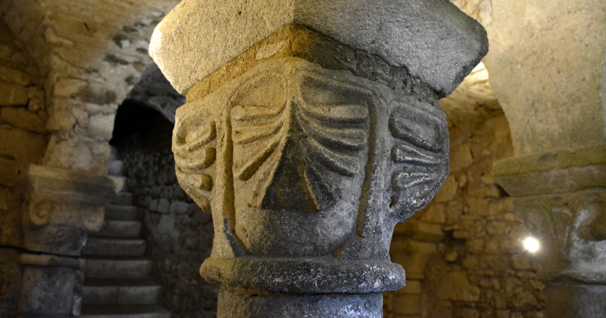
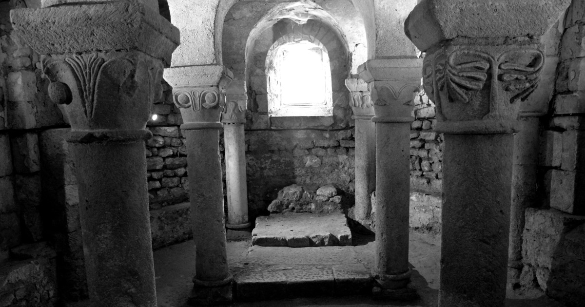
The entry to the mysterious Roman crypt can be found near the altar beneath trap doors. Navigating the steep stairs is awkward, but at the bottom is a beautiful square room from the XIth century, with an apse pierced by a single window at the end of the room.
The ceiling consists of nine vaults which rest on a series of columns, four open in the center and ten tucked into the walls (one is a replacement). The open columns in the center are monolithic, featuring sculpted decoration in the form of flowers.
The north wall in the church is the only one that survives from before 1873 when the church was restored to what it is today. The painting on wood depicting a scene of the crucifying of Christ was discovered in the sacristy anno 1995-1996, and restored.
Open – Open all year
Address – 85540 Curzon
GPS coordinates – 46°26′54″N 1°18′29″W
Tip – Les Ponts de la Claye, are two historic bridges a cross the river Lay (three arches) and the river Petit-Lay (two arches). The bridges first show on maps made in the 18th century, and made of granite (engineer Etienne Raimbaud)
Nearby sightseeing – the Marais Poitevin can be explored by canoe from this village.
Images by – inthevendee.com
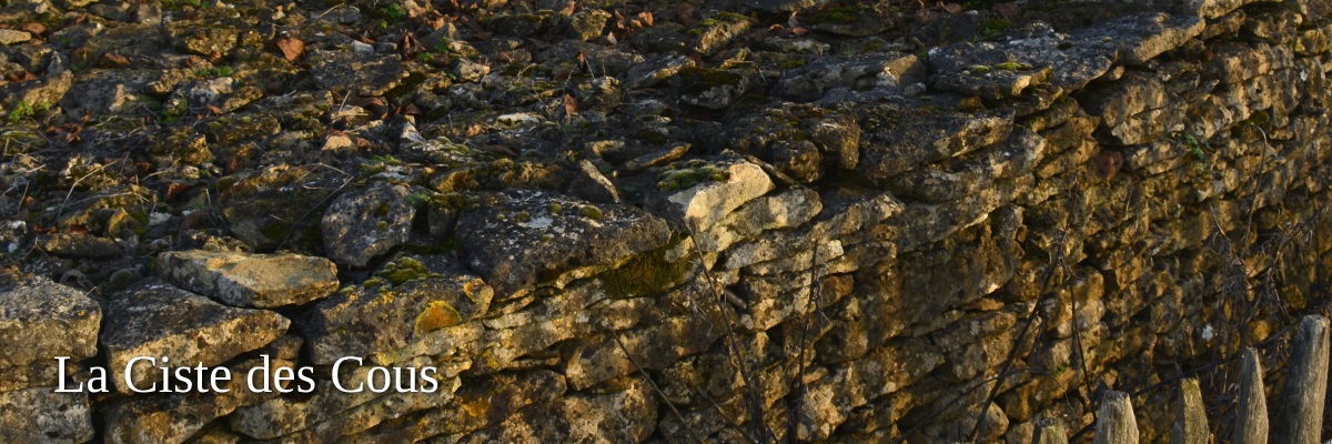
The oldest megalithic monument in the Vendée
Since 6000BC there is evidence of settlement around the village of Bazoges-en-Pareds. La Ciste des Cous, the oldest megalithic monument in the Vendée, is located in the rolling farm fields outside the village. Find the dirt-road off the D43 direction Miteau-les-Champs, marked only by a faded signpost.
The restored Neolithic dolmen is an unusual polygonal chamber is shaped by a stepped circular cairn. The ancient grave-site was first excavated in 1913. Just a short distance away from it lies the largely destroyed dolmen of Pierre Folle des Cous.
You can also walk from here up to the Donjon de Bazoges in the village, the huge high castle from the Middle Ages that has been beautifully preserved and also has a beautiful medieval garden with pigeon tower.
Open – Year-round
Tip – visit the Donjon de Bazoges (a beautifully preserved castle keep) Always there to view, but the keep is open only in the summer. The last weekend of July and first weekend in August there is a nighttime medieval festival... a must see, by reservation only. Don't miss it!
Address – Les Cossonnières
85390 Bazoges-en-Pareds
GPS coordinates – 46°39'30,6"N , 0°56'2,8"W
Nearby sightseeing – Musee Maison Clemenceau (Opened by President Macron in June 2018) Musee Clemenceau-de Lattre, La Colline des Moulins (see above)
Images – by inthevendee.com
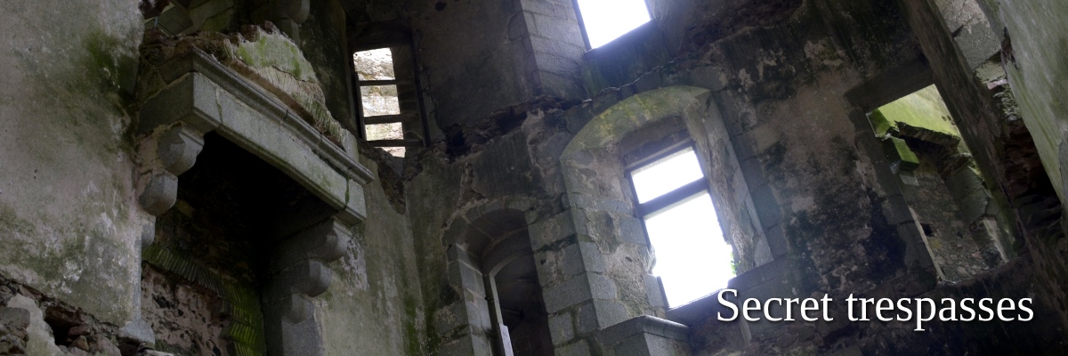
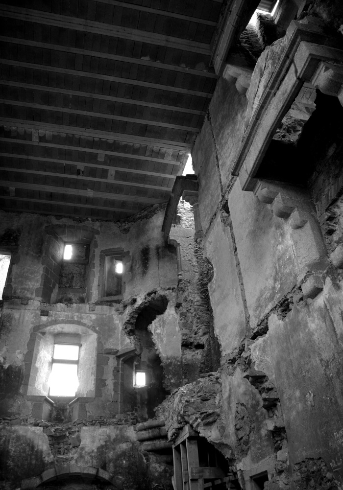
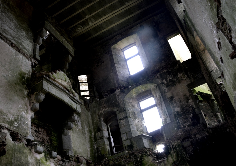
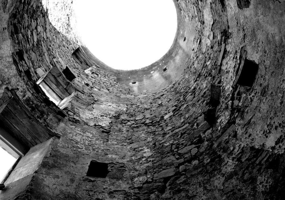
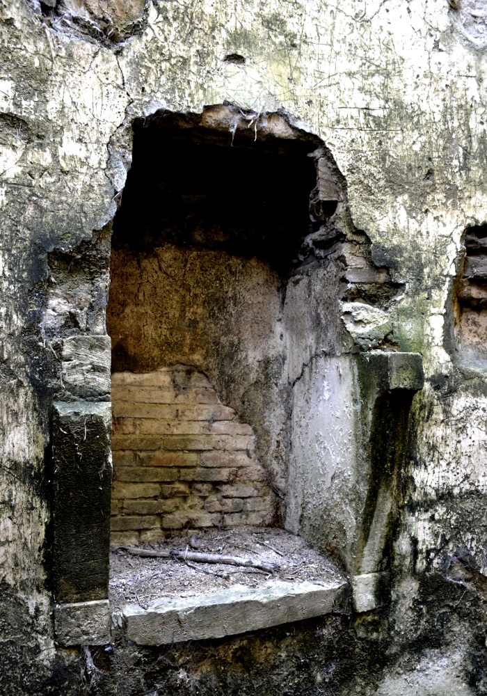
We couldn't keep these from you!
As mentioned in the blog post about our day trip to Oradour-sur-Glane, there are times (amateur) photographers will go through great lengths to get the images they want. Indeed, even adventurers will go through a lot to satisfy their curiosity.
We therefore take you on our secret voyages of discovery with two photos of an old castle where all floors are missing, giving it something etherical and mysterious for our photographic purposes.
We also show you two pictures of an old windmill that has been slightly restored on the outside but not yet on the inside. The layers upon layers of texture are just stunning.
Open – No
Tip –We would never tell you not to be adventurous. But be careful, especially if you're going to be trespassing. Make sure eye protection and a construction helmet are in the car. You never know what opportunity may present itself. Be VERY respectful!!!
Address – Our lips are sealed!
GPS coordinates – Not even that!
Images – by inthevendee.com
Finding hidden spots in the Vendée is not difficult.
With history spanning from 4000BC, through medieval times and beyond the wars that plagued the Vendée area for so many centuries, there must be tons of places that have yet to be discovered. We hope! Don't be afraid to veer off the beaten path, ignore the little voice in you that says not today.
One of the coolest things in this beautiful region of France, is that once you make the decision to ignore the GPS, you'll arrive at a spot that is rarely visited and there will be time to explore in a very peaceful setting.
Share this Post