LIVING, Recipes, baking-in-france, baking-in-the-vendee, bread and hot chocolate, bread. home-made bread, European style milk bread ingredients, home made bread, homemade bread, how do I make bread, how to bake bread, how to bake brioche style bread, I-love-baking, is milk bread just brioche, milk bread, why is milk bread so good, wintery bread
Prehistoric Vendée
One of the most unique features of the Vendée is the opportunity it lends to travel from time period to time period throughout history, and even pre-history. With evidence of life in the area dating back to Neolithic times, the Vendée proves ideal to take the entire family on a fun learning expedition away from school!
A brief history –
What is prehistory?
It is the period of time that begins with the appearance of human beings (approx. five million years ago) and ends with the invention of writing(approx. 6,000 years ago). The prehistory is divided into three stages: the Stone Age, the Bronze Age, and the Iron Age. These consecutive periods are determined by the human sociological progression and evolving e.g. in survival practices, tools and the use of pottery.
What is Neolithic and which prehistoric time period does it span?
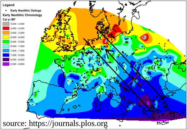
The Neolithic transition (when human beings made the progression from foraging to farming) was also a process of migration from the Near East throughout Europe over the course of thousands of years, at an average of 1 km per year (0.6–1.3 km/yr).
The graph below left shows early neolithic movement originating from the south-east of Europe.
There was a gradual progression of behavioral and cultural practices such as the creation of settlements, the use of wild and domestic crops, and of the domestication of animals. Crops included lentils, einkorn wheat, millet, and spelt, By about 6,900–6,400 BC, in addition to the keeping of dogs, sheep and goat, farming also included domesticated cattle and pigs.
The Neolithic period is widely regarded as the cradle of civilization!
What about the Vendée?
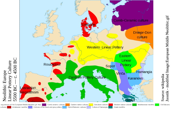
While the Neolithic period begins some 12,000 years ago, in Europe it is considered to be from 7000–3000 BC. In the Vendée there is archaeological evidence of prehistoric life from around 6000 BC. The graph below right shows that the use of western native pottery and linear pottery is rooted in the migration pattern originating from the Near East. It is also known as cardium pottery, a Neolithic decorative style of clay imprinted with the cockle shell.
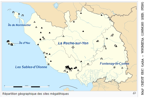
About the center graph –
The center graph shows a map of prehistoric locations in the Vendée today. Scroll down for a comprehensive list (not including the monuments that were removed or destroyed or became a part of another structure.) The list includes GPS coordinates.
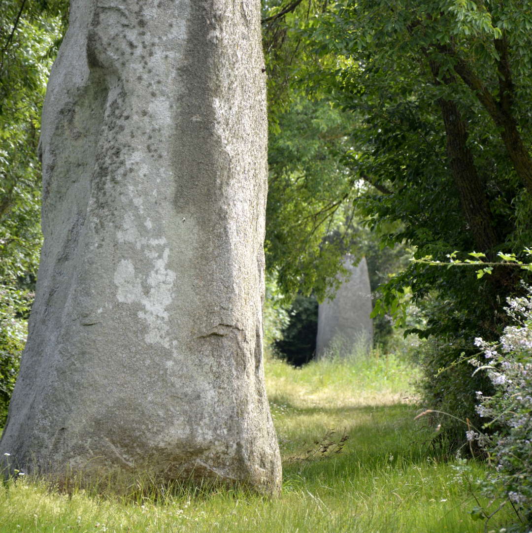
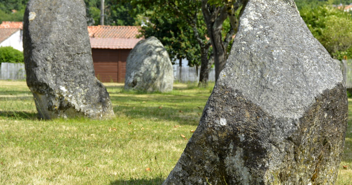
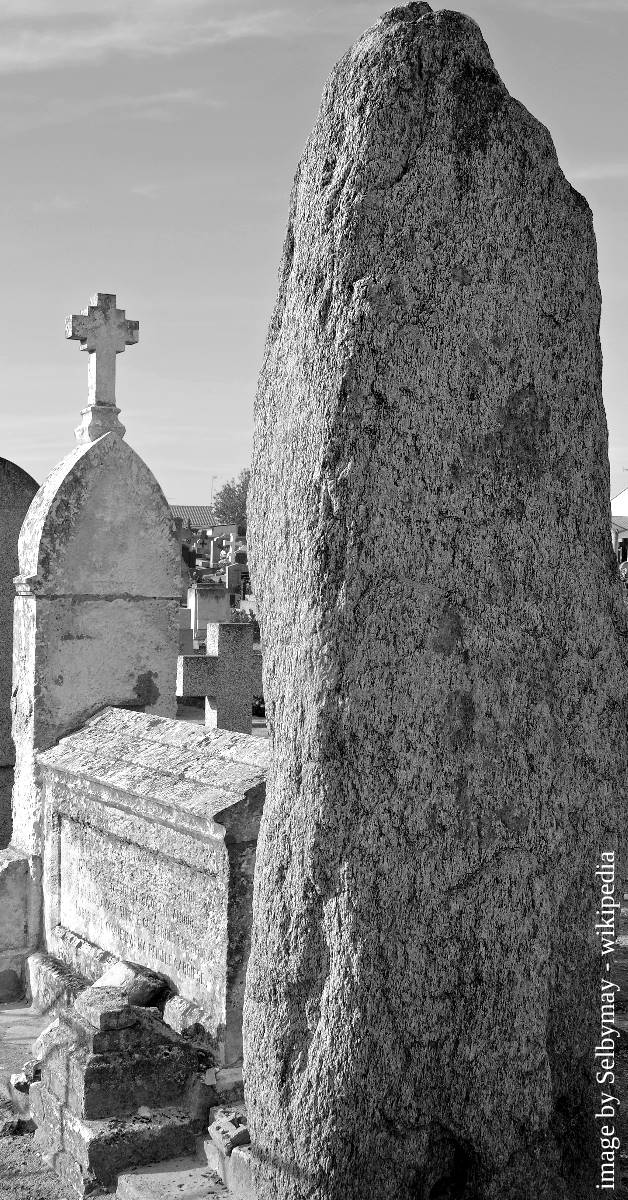
Menhirs du Plessis
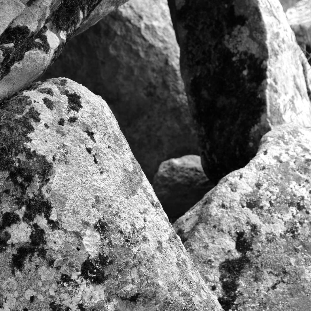
Dolmen Savatole
La Ciste des Cous

Le Bernard-Unidentified
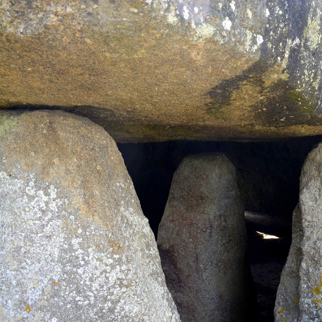
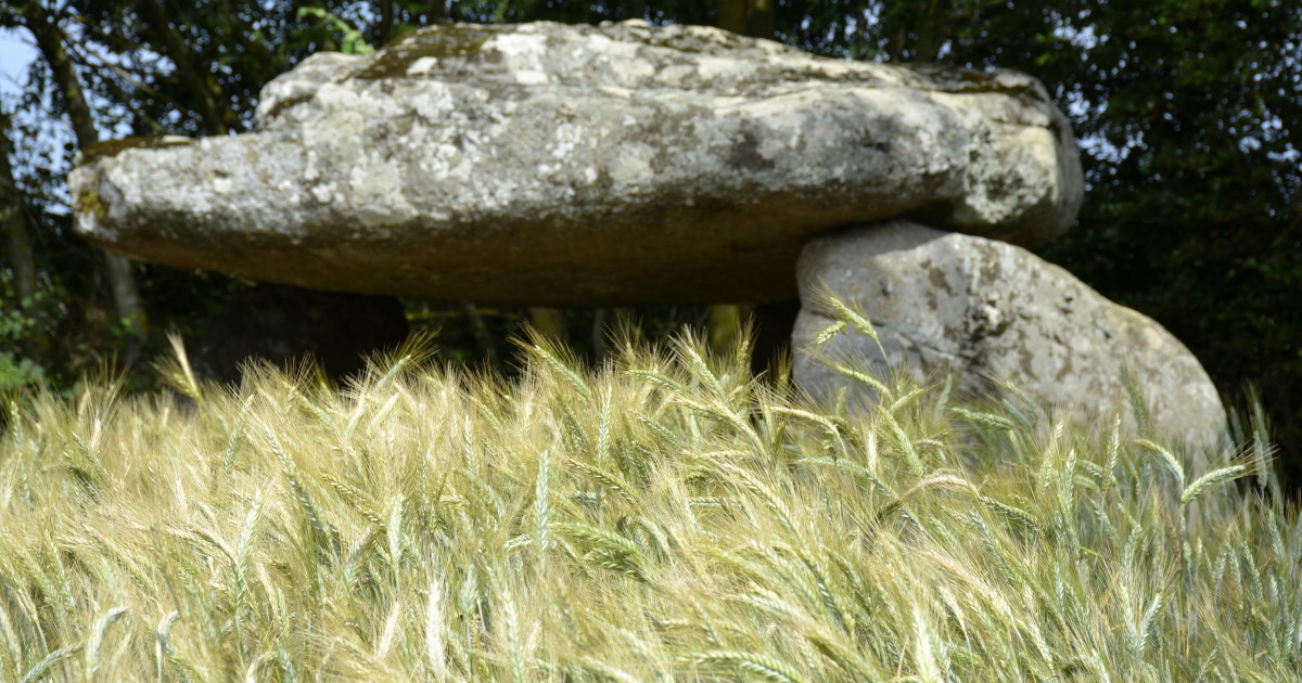
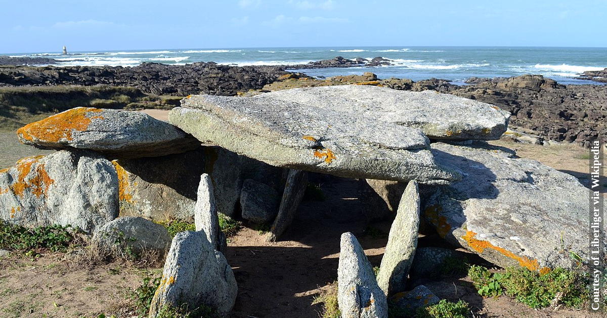
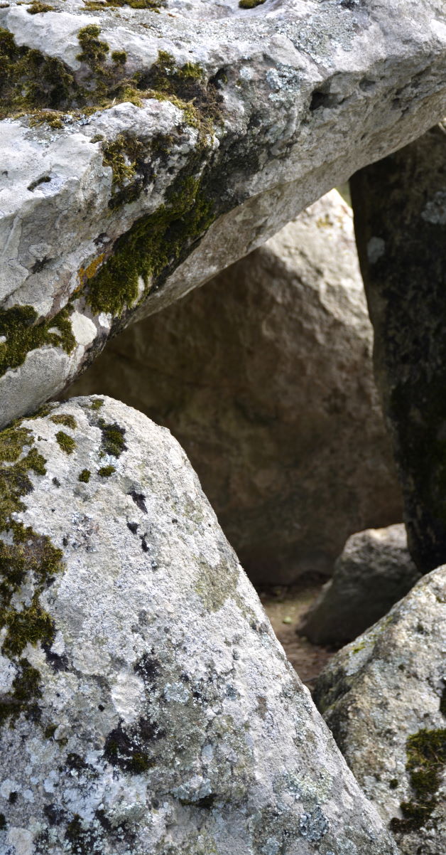
Dolmen Frébouchère
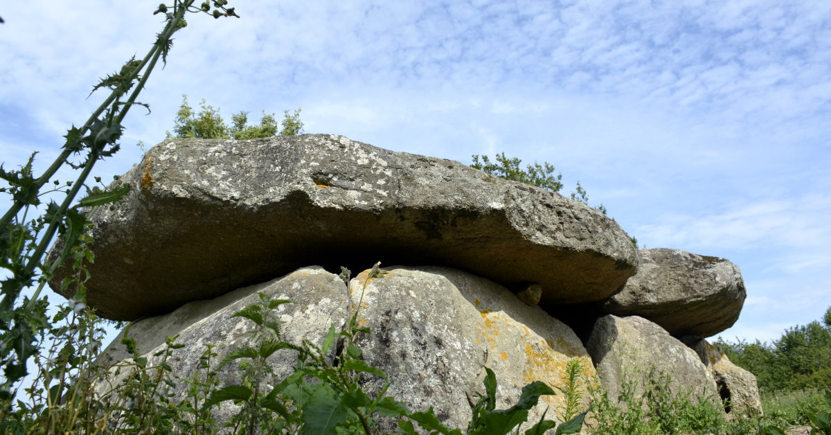
Dolmen de la Frébouchère
Dolmen de la Sulette
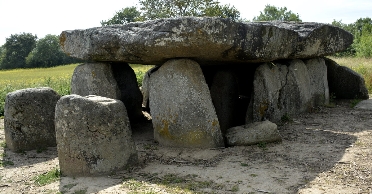
Dolmen de la Frébouchère
Dolmens de Avrille (village)
Dolmen de la Planche-à-Puare
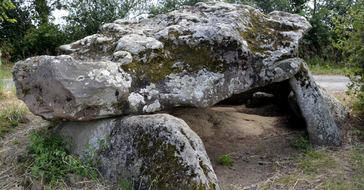
Dolmens de Savatole - 2
Prehistoric Vendée GPS Coordinates: a list
Avrillé
Alignement de la Petite Pierre – 46° 28′ 11″ N, 1° 30′ 47″ O
Alignements du Bois de Fourgon – 46° 28′ 11″ N, 1° 30′ 06″ O
Menhir de Bourg-Jardin – 46° 28′ 09″ N, 1° 29′ 44″ O
Alignements du Bois de Fourgon – 46° 28′ 11″ N, 1° 30′ 06″ O
Menhir de Bourg-Jardin – 46° 28′ 09″ N, 1° 29′ 44″ O
Menhir de la Boilière – 46° 28′ 00″ N, 1° 28′ 57″ O
Menhir de la Fontaine Saint-Gré – 46° 27′ 36″ N, 1° 29′ 04″ O
Menhir de la Pièce-du-Rocher – 46° 28′ 38″ N, 1° 30′ 39″ O
Menhirs du Champ de la Pierre – 46° 28′ 48″ N, 1° 29′ 26″ O
Bazoges-en-Pareds
Menhir des Landes – 46° 40′ 12″ N, 0° 57′ 39″ O
Nécropole des Cous – 46° 39′ 31″ N, 0° 56′ 03″ O
Pierre-Levée des Landes – 46° 40′ 33″ N, 0° 57′ 05″ O
Le Bernard
Cairn du Pey-de-Fontaine – 46° 25′ 30″ N, 1° 25′ 53″ O
Dolmen de la Frébouchère – 46° 27′ 02″ N, 1° 28′ 05″ O
Menhirs du Plessis – 46° 27′ 27″ N, 1° 26′ 42″ O
Pierre Folle du Plessis – 46° 27′ 03″ N, 1° 26′ 25″ O
Pierre-Levée de la Cour du Breuil – 46° 25′ 59″ N, 1° 27′ 12″ O
Brem-sur-Mer
Menhir de la Crulière – 46° 36′ 26″ N, 1° 48′ 34″ O
Brétignolles-sur-Mer
Pierre Levée de Soubise – 46° 36′ 42″ N, 1° 50′ 58″ O
Chauché
Menhir de la Limouzinière – 46° 49′ 56″ N, 1° 16′ 09″ O
Cheffois
Pierre-qui-vire – 46° 41′ 10″ N, 0° 47′ 31″ O
Pierre à cupules des Girardières – 46° 40′ 45″ N, 0° 46′ 56″ O
Polissoir de la Vésinière – 46° 40′ 48″ N, 0° 46′ 36″ O
Commequiers
Dolmen des Pierres-Folles – 46° 45′ 12″ N, 1° 51′ 00″ O
Menhir de la Grand'Pierre – 46° 46′ 25″ N, 1° 51′ 51″ O
Corpe
Dolmen de la Frise – 46° 29′ 51″ N, 1° 11′ 44″ O
La Garnache
Pierre du Diable – 46° 52′ 05″ N, 1° 53′ 09″ O
Le Givre
Menhir du Champ du Rocher – 46° 27′ 25″ N, 1° 24′ 07″ O
Menhir des Petites Jaunières – 46° 27′ 24″ N, 1° 23′ 41″ O
L'Île-d'Yeu
Allée couverte des Tabernaudes – 46° 43′ 35″ N, 2° 22′ 59″ O
Dolmen de la Guette – 46° 41′ 50″ N, 2° 19′ 40″ O
Dolmen de la Planche-à-Puare – 6° 43′ 38″ N, 2° 23′ 22″ O
Dolmen des Landes – 46° 41′ 52″ N, 2° 20′ 05″ O
Dolmen des Petits Fradets – 46° 43′ 53″ N, 2° 22′ 47″ O
Menhir du Chiron Lazare – 46° 42′ 24″ N, 2° 22′ 22″ O
Menhir du Sud – 46° 41′ 33″ N, 2° 19′ 24″ O
Pierre des Quatre-Chemins – 46° 42′ 41″ N, 2° 21′ 01″ O
Longeville-sur-Mer
Pierre-qui-vire – 46° 25′ 13″ N, 1° 30′ 25″ O
Monsireigne
Menhir de la Chauvinière – 46° 45′ 31″ N, 0° 54′ 54″ O
Noirmoutier-en-l'Île
Dolmen de la Pointe de l'Herbaudière – 47° 01′ 27″ N, 2° 18′ 25″ O
Dolmen de la Table – 46° 59′ 34″ N, 2° 10′ 07″ O
Menhir de la Pointe des Dames – 47° 00′ 40″ N, 2° 13′ 14″ O
Notre-Dame-de-Riez
Menhir du Pré-Doux – 46° 45′ 10″ N, 1° 54′ 17″ O
Pierre au Trésor de la Triée – 46° 44′ 58″ N, 1° 54′ 13″ O
Olonne-sur-Mer
Conche Verte – 46° 34′ 17″ N, 1° 49′ 35″ O
Menhirs de Pierre-Levée – 46° 31′ 45″ N, 1° 45′ 03″ O
Le Poiré-sur-Vie
Pierre des Farfadets – 46° 46′ 52″ N, 1° 33′ 48″ O
Rosnay
Pierres-Folles – 46° 31′ 39″ N, 1° 17′ 57″ O
Saint-André-Treize-Voies
Menhir de la Petite-Roche – 46° 55′ 46″ N, 1° 24′ 23″ O
Saint-Germain-de-Prinçay
Menhir des Roches-Baritaud – 46° 43′ 49″ N, 1° 03′ 49″ O
Saint-Gilles-Croix-de-Vie
Menhir de la Tonnelle – 46° 41′ 57″ N, 1° 56′ 19″ O
grave site Marcel Baudouin
Saint-Hilaire-la-Forêt
Dolmen de la Sulette – 46° 27′ 19″ N, 1° 30′ 43″ O
Dolmen des Créchaudes
Dolmen des Créchaudes – 46° 27′ 05″ N, 1° 30′ 42″ O
Menhirs de la Rainière – 46° 28′ 17″ N, 1° 31′ 41″ O
Saint-Vincent-sur-Graon
Menhir de la Chenillée – 46° 27′ 46″ N, 1° 22′ 25″ O
Saint-Vincent-sur-Jard
Dolmen du Grand-Bouillac – 46° 25′ 33″ N, 1° 32′ 26″ O
Soullans
Menhir de la Vérie – 46° 49′ 17″ N, 1° 53′ 56″ O
Thiré
Dolmen de Pierre-Folle – 46° 33′ 09″ N, 0° 59′ 53″ O
Vairé
Menhir de la Pierre Combe – 46° 36′ 06″ N, 1° 46′ 06″ O
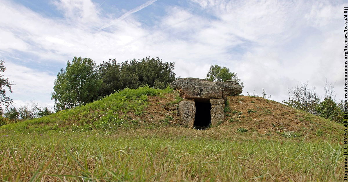
Open – The monuments listed here are open year-round and free to visit, however, as so many are located in rural Vendee farm fields, they may not be visible.
Tips – Please be respectful of farmer's crops.
Address – Please use GPS coordinates
Parking – may not be possible - some menhirs are only visible from a busy departmental road
Bicycling – yes e.g. around Avrillé or Le Bernard, pack a pic-nic, park the car and cycle your way from monument to monument
Menhir de la Tonnelle
Dolmens de Savatole- 1
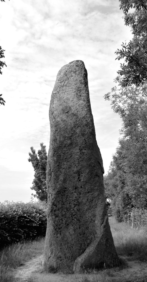
Menhirs de Plessis
Route planning... or not?
More area sightseeing – In many cases, sightseeing the prehistoric Vendée is an adventure in and of itself. Most artifacts are to be found in rural settings, sometimes IN the farmfields of the Vendéen countryside or even in village neighbourhoods.
On route to Vendée sightseeing, it's fun to follow the road signs that indicate historical and prehistorical monuments. The most densely populated area to explore menhirs and dolmen, is located around Avrillé. Planning is not really necessary. Just follow the signs and let yourself be surprised. Be aware that you may need to take sharp turns and traverse unpaved country roads, e.g. the village of Bazoges-en-Pareds boasts one of the most amazing medieval donjons in the Vendee, with the prehistoric Ciste des Cous located in the farm fields outside the village.
Reading material (French): Les fouilles du Docteur Guérin sur l'éperon des Châtelliers-du-Vieil-Auzay (Vendée)
Sources: wikipedia, https://journals.plos.org
Images: inthevendee.com unless noted otherwise
Share this Post