LIVING, Recipes, baking-in-france, baking-in-the-vendee, bread and hot chocolate, bread. home-made bread, European style milk bread ingredients, home made bread, homemade bread, how do I make bread, how to bake bread, how to bake brioche style bread, I-love-baking, is milk bread just brioche, milk bread, why is milk bread so good, wintery bread
Discover Montaigu-Vendée
In Gallo-Roman times on an intersection of two important Roman 'highways' grew the village of Durivum. Situated in the very north of the department of Vendée, the village known since 2019 as Montaigu-Vendée is a treasure. The vision of the Lords of Montaigu included a focus on education, a vision whose affect can be felt even today, making Montaigu and its array of fused villages a desirable place to live. But the area is also hilly and, thanks its many streams and rivers, lushly green and ideal for viticulture. Our investigation not only revealed Durivum's intersection in Roman times... in the Vendée we know that where a rich history, water, vineyards and castles meet, we have discovered an ideal spot for exploration and discovery. Welcome to Montaigu-Vendée!
History –
The ancient Durivum (also Durinum) was a historic village between Brittany, Anjou and Poitou. In Roman times it may have been one of the most important locations of the Bas-Poitou region, located on the intersection of two Roman 'highways' (Viae stratae seu calcatae), one coming from Nantes and Rezé and going to Limonum (Poitiers); the other going from Angers to the ocean by Ségourie.
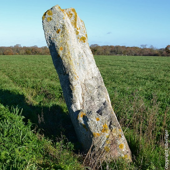
While Durivum was established during the Roman era, there is evidence the area was populated much earlier than that with pre-historic remnants like the Menhir du Grande Bernerie.
By the 8th Century the village was renamed. Derived from the Latin mons acutus, meaning 'sharp mountain', it became Montaigu. Under roman influence it had been developed to a commercial hotbed but was destroyed in the Viking invasions that plagued the Western coast of France.
In the 9th Century the village was known as Saint-Georges-de-Montaigu. To protect against persistent Viking raids, a castrum (wooden castle on a mound of earth) surrounded by a palisade wall was built strategically where the Maine and L'Asson rivers meet.
In the 10th century the Lord of Montaigu was established in the village but the first Lord of Montaigu mentioned (in 1099 - so, 11th Century) was Maurice I de Montaigu, whose daughter Agathe wed Brient I de Commequiers, Maurice's successor. They had three children, the oldest of whom, Brient II, became Lord of Montaigu in 1174. It is probably he who may have ordered the construction of a Romanesque keep (a square tower with flat towers at each corner), and ordered for the wooden palisade to be replaced by a wide dry mote.
After the Montagues pledged their allegiance to the Plantagenets, Henry II, Richard the Lionheart and Jean-sans-Terre, the complex history of Montaigu continued as follows:
- 1203: Marguerite de Montaigu married Hugues de Thouars.
- 1227: the couple submitted to Philip Augustus, first proclaimed King of France.
- 1229: Hugues de Thouars died
- 1235: Marguerite wed the Duke of Brittany - Pierre de Dreux (Mauclerc).
- 1241: Marguerite de Montaigu died childless.
- 1250: nephew Maurice III became lord of Montaigu until his death
- 1277: the seigneury passed to the Belleville family.
- 1328: Jeanne de Belleville, daughter of Maurice IV of Montaigu, married Olivier IV of Clisson.
- 1343: Olivier IV was executed by decapitation, suspected of siding with the English in the middle of the Hundred Years War.
- The castle of Montaigu was then in the hands of the English
- In revenge, Jeanne became a pirate attacking French ships together with her children. They were banished from the kingdom of France, retiring to England.
- 1362: Olivier V, now an adult, rallied to the king of France, recovered his property and fought the English alongside Bertrand du Guesclin.
- 1373: Olivier and Bertrand succeeded in driving the English out of Montaigu and Olivier gave the seigneury to his sister Jeanne who had married an English captain, Jean Harpedenne.
- 1373: Jean Harpedenne sided with the King of France and became Jean de Belleville.
- 1433: Jean III, grandson, married the half-sister of Charles VII, Marguerite de Valois .
- Louis I de Belleville succeeded Jean III.
Upon advice of King Louis XI Louis I de Belleville fortified the city between 1464 and 1468 (in protection against the Bretons). A large stone castle boasting twelve towers was attached to a large fortified city consisting of ramparts and three fortified gates. A 16-meter dry ditch separated the fortified city from the fortress. La Digue (see below) was also a unique part of the city's strategy, an embankment where one could defend standing but also with boats.
The Montaigu Lords possessed extensive executive and judicial powers which included an army of knights, and land administrators who collected taxes.
The village grew to be powerful with a thriving community of merchants and commerce. Montaigu was the center of seigneurial administration and trade. The Lords were also proponents of education, pioneering schools to be built for teaching purposes. It was a vision that would have a lasting positive effect on the area.
In the 16th century, the French king Henri III (whose parents were Henry II of France and Catherine de Medici) limited seigniorial independence throughout the country, so too in Montaigu, which became a "seneschalty". In medieval France, a seneschal was an administrator or royal steward governing the entire country but over time this important duty morphed into the seneschal serving as the chief justice of the royal courts in a particular area. Montaigu now included a court and prisons.
In 1793 the Battle of Montaigu took place. For that story, keep reading below images.
After the revolution, around 1810, the function of court and law disappeared from the village, events that stole some of its influence over the region but thanks to its powerful presence and development spanning the previous centuries, and mainly due to the many schools Montaigu was renowned for, it remained an important center for trade, notaires (lawyers), doctors, family businesses, and agricultural development.
Even today Montaigu is still appreciated for its many medical services, and its position as an industrial, commercial, administrative, and educational community. In a merger of local communes consisting of Boufféré , La Guyonnière , Saint-Georges-de-Montaigu , Saint-Hilaire-de-Loulay and Montaigu, the municipality effectively became Montaigu-Vendée on January 1st, 2019.
As the fourth most populated municipality in the department of Vendée it rests between La Roche-sur-Yon, Les Sables-d'Olonne and Challans, ahead of Les Herbiers and Fontenay-le-Comte.
Below images: Battle of Montaigu + things to see and do
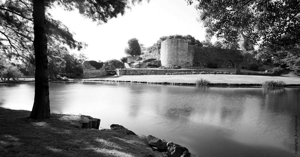
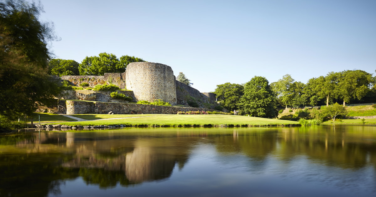
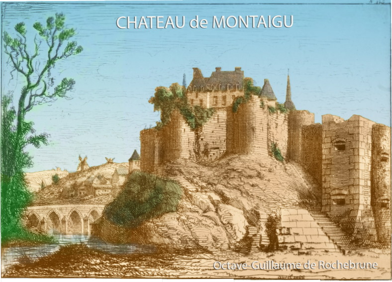
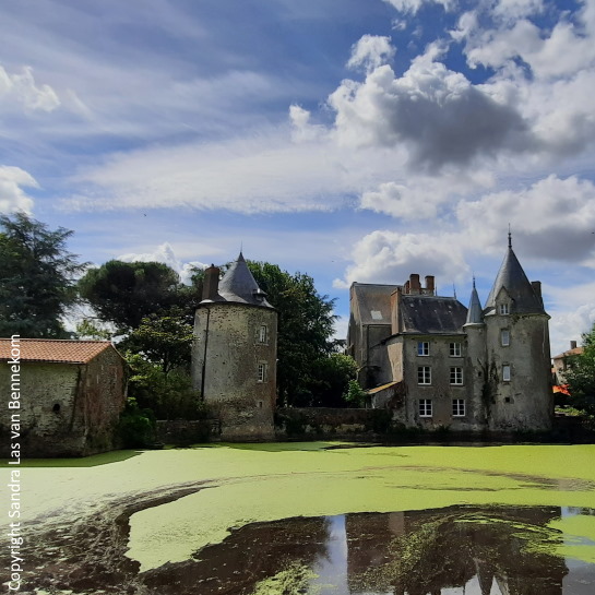
Chateau de Montaigu
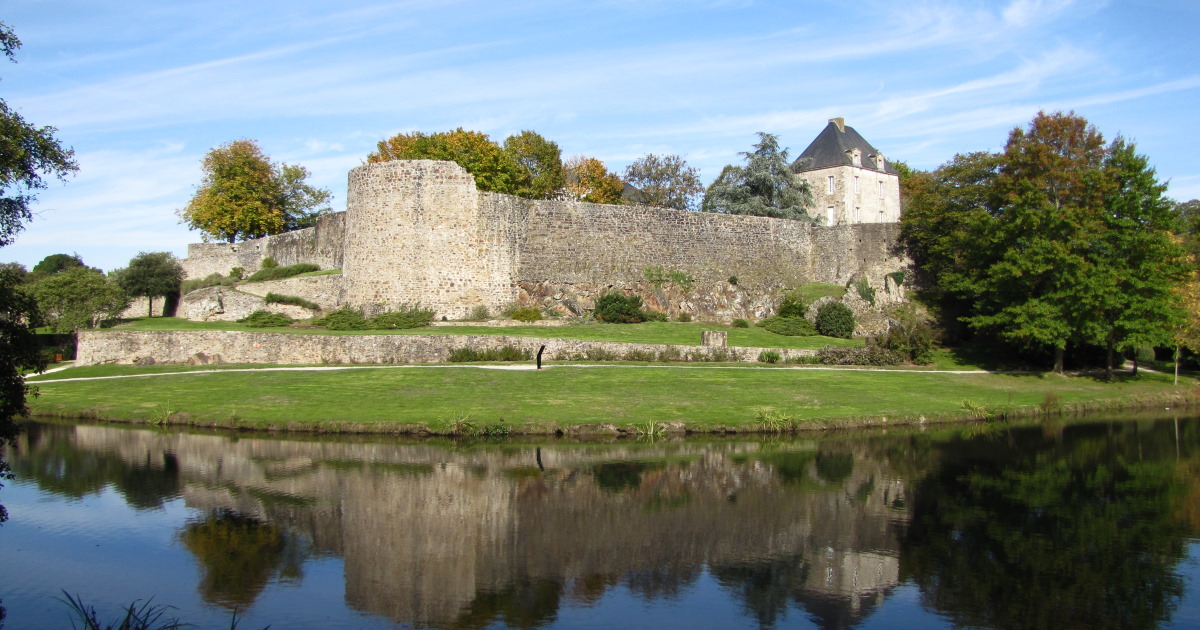
Chateau de Montaigu
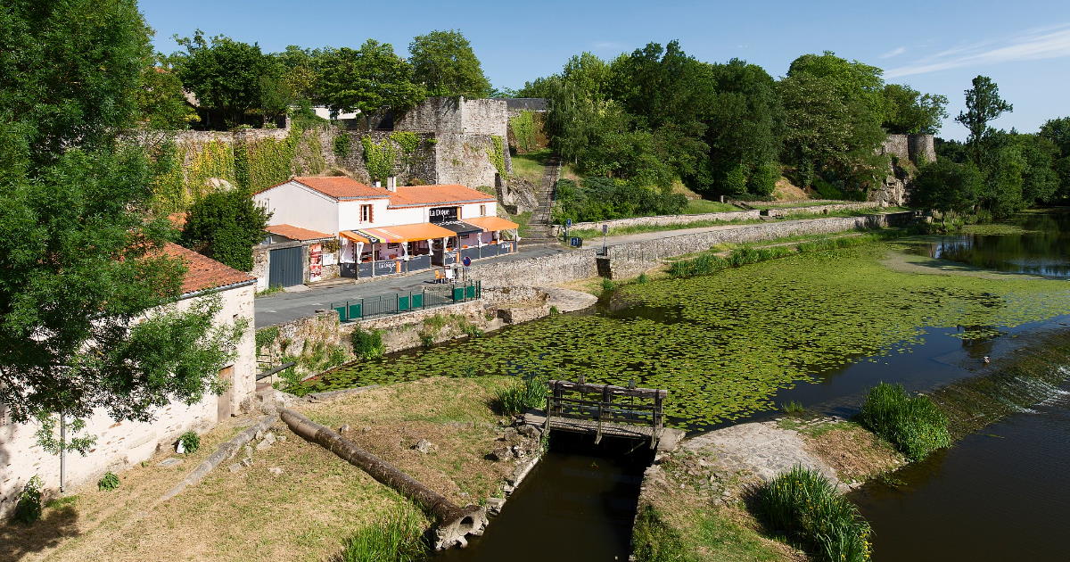
LA DIGUE NEAR PONT SAINT NICOLAS
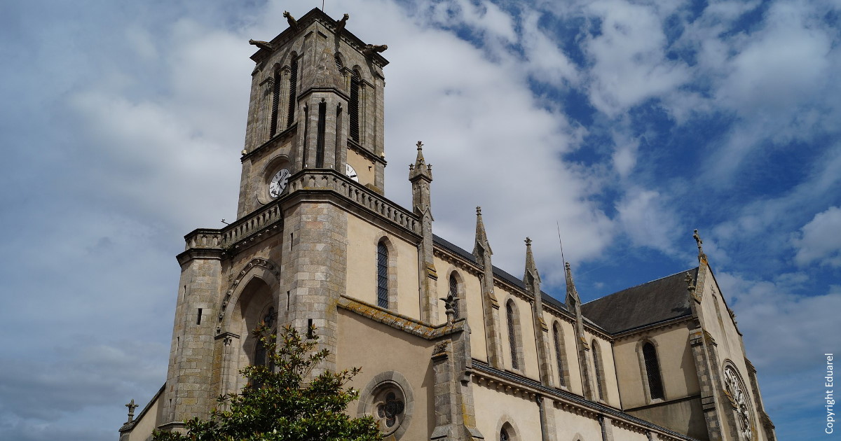
Church Saint Jean Baptiste
The Battle of Montaigu -
Vendée Wars of 1793
(French Revolution 1789 - 1799)
Battle GPS location: 46° 58′ 25″ N, 1° 18′ 31″ W
On 14 September 1793, the Army of Mainz and the Army of the Coasts of Brest continued their attempt at defeating the royalists of the Vendée.
Royalist leader Couëtus was defeated the previous day near Saint-Jean-de-Corcoué, while Republican general Beysser pushed François Lyrot (General in the Armée catholique et royale) back to Les Sorinières.
Thousands of Vendéen refugees converged on Legé 40km south of Nantes and headquarters of the revered Vendée General Charette. The chaos caused General Charette to realize they were at a dangerous disadvantage.
At dawn on September 14, as the Republicans approached, Charette ordered his cavalry to prepare to engage in the fight, allowing time for his infantry and the civilians to flee. He then cleverly withdrew, leaving Legé abandoned but for some 1200 patriotic military personnel and civilians captured by the royalists.
General Kléber's division entered Legé first and released the prisoners. Next to arrive was General Beysser whose troops brutally looted the town.
Next to be conquered, was Montaigu. The Republican army marched on three separate columns under Generals Aubert-Dubayet, Kléber, and Beysser. On the evening of 15th September 1793, Beysser's column arrived within sight of Montaigu.
The next morning, the royalist Vendéens marched bravely to meet a 6000-strong Republican army near the town of Saint-Georges-de-Montaigu. Despite a heavy downpour, the battle lasted several hours.
General Kléber, who had been delayed by an accident with his company's artillery train, arrived next at Montaigu, causing panic among the Vendéens. They withdrew towards nearby Clisson but, persued by the cavalry of General Bouin de Marigny, many were killed along the way.
Division General Louis-Marie Turreau issued permission for General Kléber to charge on Clisson but denied General Beysser the same order. After the battle, he deemed the troops too exhausted to continue the march.
By then Montaigu had been deserted by its inhabitants. The Republicans left behind 'to rest' saw fit to loot this village as well. According to Kléber's memoirs, General Beysser himself took part, an act that saw him arrested and decapitated.
The historical almanac of 1793 reported the battle left 7 dead and 50 wounded among the Republicans and 1,500 killed among the Brigand royalists. Kléber wrote that he saw the suburb of Montaigu "littered with the corpses of the rebels".
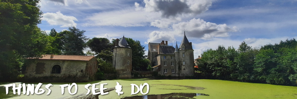
Things to see and do in Montaigu-Vendée
Route Planning and Preparation
The Montaigu-Vendée area is reachable via the A83 (5 min) and the A87 (20min)
Montaigu
- GPS: 46 ° 58 ′ 27 ″ N, 1 ° 18 ′ 49 ″ W
- Market: Saturday mornings from 8h30 to 12h30
- Château de Montaigu whose fortifications were leveled in 1586 by order of Henri III.
- Church Saint-Jean-Baptisteanno 1241 this was already a proper church but what is here today dates from 1864. The new church was constructed on the site of the old one in the neo-Gothic style of the XIXth century.
- The Saint-Léonard gate located next to the Mairie of Montaigu. Saint Leonard was the patron of the prisoners and the sick. This beautiful portal was once part of a XIIIth century chapel constructed to commemorate the liberation of Hugues de Thouars who was captured during a ride on the lands of King Philippe-Auguste. When the chapel is destroyed, the portal was dismantled and made a part of a wall of the old hospice de Montaigu; then again dismantled to be brought to where it stands today.
- La Digue or the dam built between 1476 and 1480 as part of the city's (castle's) defense system.
- WALKING TRAILS
- Rivières & Abbaye (Montaigu) – 24,5 km
- La Sénardière (Montaigu) – 7,3 km
- De l’Écornerie au Bois Noir (Montaigu) – 18,2 km
Saint-Hilaire-le-Loulay
- GPS 47° 00′ 07″ N, 1° 19′ 54″ W
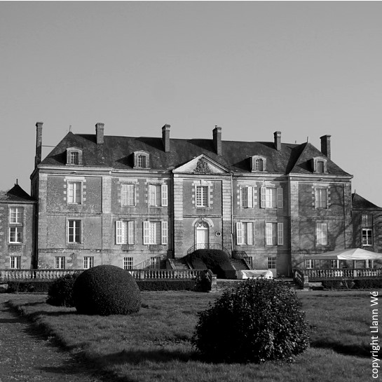
- Castles include: Château de la Preuille, Château de Mussetière, Château La Lande, Château Bois-Corbeau, Château La Peinerie, Château de la Grande Bernerie.
- Rivers include Le Loulay, Riaillé, Blaison, Hosea and the river Maine featuring 8km of lush and treelined embankments.
- The Menhir de la Grande Bernerie is evidence of pre-historic activity in the area
- Walking trail l'Ecornerie along the banks of the Maines Réunies, discoverthe painting "The Miracle of the Brandeum" and the stained glass windows by Jean Chevolleau; and a view of the roadway once the only passage to reach the village before the construction of the bridge. Starting point: car park of the church in Saint Hilaire de Loulay. 12km Route marked in yellow (3 hours walk).
- The Sénard bridge spanning the Maine river. Built in the classical Middle Ages the bridge is fodder for local legend and folklore. Rumor has it that following difficulties in finishing the bridge, the builder made a deal with the devil in exchange for the soul of the first passerby. But, seized with remorse, the Blessed Virgin sent a donkey across the bridge. In retaliation, the devil swore the bridge would never be finished. Stones missing from this bridge today!
- Wine at CHÂTEAU DE LA
PREUILLE winery from Monday to Thursday from 9h30 - 12h30 and 14h00 - 16h00 La Preuille, 85600 Saint-Hilaire-de-Loulay. Tél : +33251463232 - WALKING ROUTES
- L’Écornerie (Saint Hilaire-de-Loulay) – 12,4 km
- Le Bois Noir (Saint Hilaire-de-Loulay) – 7,7 km
Boufféré
- GPS 46° 57′ 44″ N, 1° 20′ 21″W
- Ruins of Château de Sénardière, 14th century castle, of which only the moat and two towers remain.
- Château du Hallay in Boufféré with its neo-Byzantine chapel
La Guyonnière
- GPS 46°57′59″N 1°14′55″W
- Logis de la Roche-Thévenin is a stunning 16th - 19th century (private) manoir with beautiful historical features including a chapel (Open to visit for Journées Patrimoines, 3rd weekend of September)
- WALKING ROUTES
- La Chausselière (La Guyonnière) – 9,6 km
- Meslay (La Guyonnière) – 12,5 km
- Les Étangs (La Guyonnière) – 21 km
Saint-Georges-de-Montaigu
- GPS 46° 56′ 52″ N 1° 17′ 37″ W
- Maison de la Rivière - old watermil previously known as the Moulin de la Roche. Open May to September for autonomous 1.5 hrs boat trips on the river Maine; or after 19h00 for a boat ride of 2hrs with an apéritif... Make reservations. Location: Place du Gué des Joncs. Tel: 02.51.46.44.67. Other activities: exhibitions and games, treasure hunts etc all set in 10 hectares of a lush natural environment on the river banks Opening hours: May - June - Sept (Wednesday: Sat. 14h - 18h; Sun and hols: 14h - 19h) July - Aug (11h - 19h daily)
- a unique experience in the treetops: perched dinners - enjoy two hours of dinner around a table in a treetop!
- Pont de Boisseau - historical monument located where the Grande Maine and the Petite Maine rivers flow together
- Aérodrome de Montaigu - Saint-Georges location of Aeroclub ulm Montaigu - with discovery flights (pending pandemic restrictions)
- Church of Saint-Georges dated XIXth century but peculiarly with an unfinished bell tower topped by a temporary slate-covered spire
- La Goyère (located Lieu-dit La Goyère) are the remains of an ancient medieval castle on a hillside overlooking the Grande Maine
- The old lavoir
- WALKING ROUTES
- La Maison de la Rivière (Saint Georges-de-Montaigu) – 5,9 km
- La Grande Maine (Saint Georges-de-Montaigu) – 11,5 km
- La Petite Maine (Saint Georges-de-Montaigu) – 10,6 km
Watersports opportunities in the greater area
In addition to Maison de la Rivière (see info above), Lac de la Chausselière and the misc. La Maine rivers offer many leisure opportunities for the whole family like canoeing, kayaking, paddle boarding, sailing, archery, orienteering, blowpipe, hiking, and fishing... even biathlon! Leisure centers include:
Base de Loisirs La Chausselière
La Chausselière,
85600 La Guyonnière
Tel: 02 53 07 31 59
Instruction and groups
Info and reservations
Tel: 06 95 44 45 89
Fishing
In addition to the lake, the area counts 34km of rivers where fishing is allowed. A fishing license is mandatory and you can purchase one at any Tourism Office or online. More information for fishing in the area here.
- La Grande Maine: from the Pont Légé to the Chaussée des Deux Rives (Saint Georges de Montaigu)
- La Petite Maine: from Fromage to La Chaussée des Deux Rives
- La Maine: from La Chaussée des Deux Rives to La Chaussée d'Heudin, on the edge of Loire Atlantique (Remouillé).
Modelisme - Remote control model boats
Camping opportunities map
Cycling routes
- From La Bernardière to Montaigu (15,6 km one-way, difficulty*) - info
- From La Bultiere to Saint-Georges-de-Montaigu (15,7 km one-way, difficulty**) - info
Images –
- Main image credit: Alexandre Lamoureux with Vendée Expansion and by inthevendee and other copyrights marked on the images
.jpg)
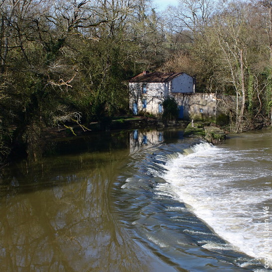
MAISON DE LA RIVIERE
CHATEAU la lande
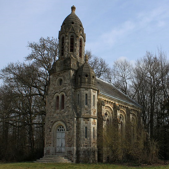
neo-Byzantine chapel
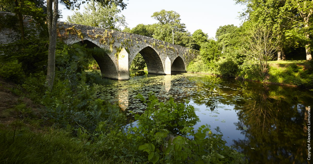
Pont de Senard sur la Maine
Coming soon: day trip to Clisson
Share this Post