LIVING, Recipes, baking-in-france, baking-in-the-vendee, bread and hot chocolate, bread. home-made bread, European style milk bread ingredients, home made bread, homemade bread, how do I make bread, how to bake bread, how to bake brioche style bread, I-love-baking, is milk bread just brioche, milk bread, why is milk bread so good, wintery bread
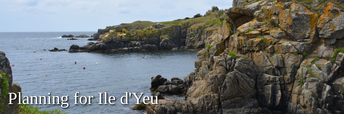
Île d’Yeu, beautiful island of the Vendée
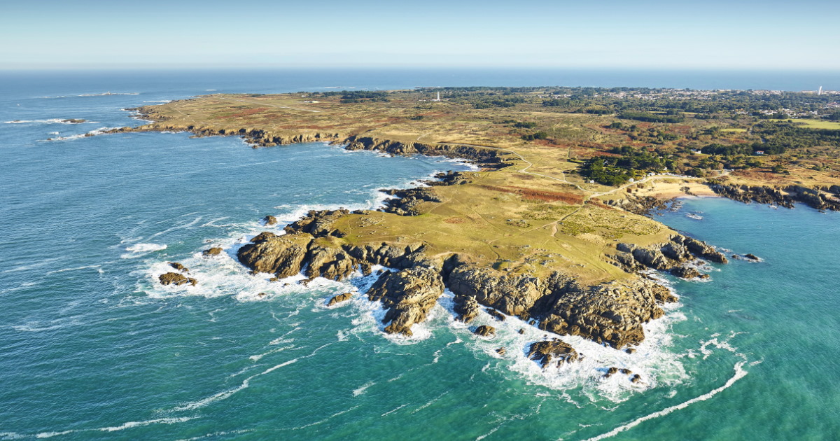
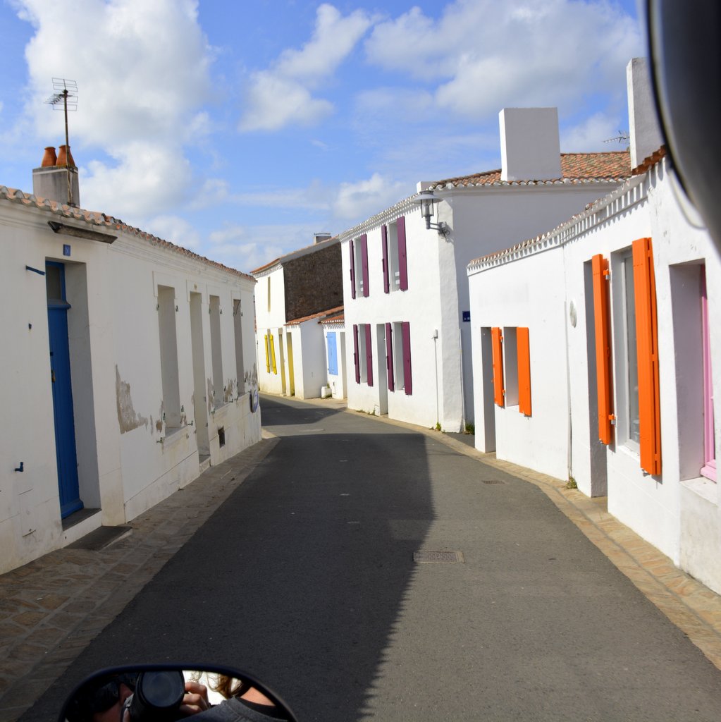
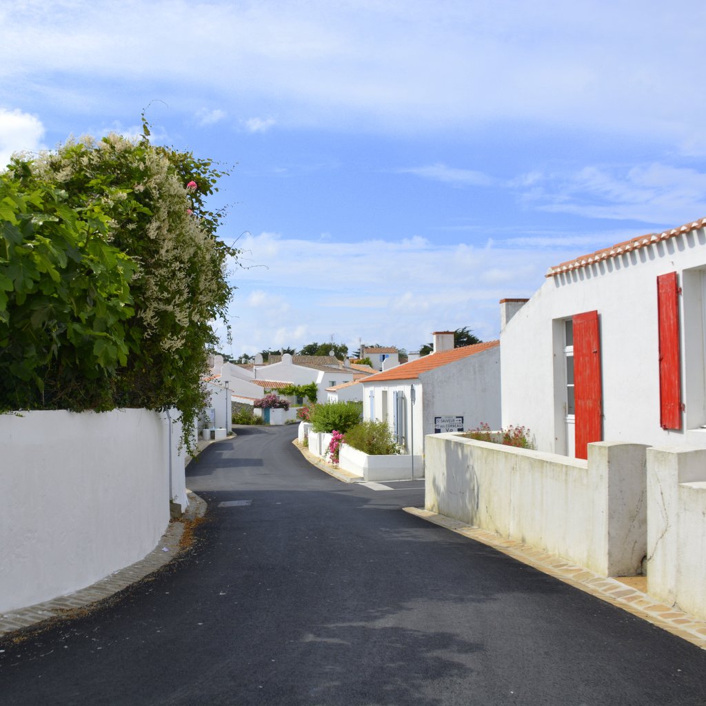
If you've ever dreamed of visiting the Greek Islands but haven't been able to realise that dream, the Vendée has a wonderful surprise in store for you. Île d'Yeu, a small island located 32km (19mi) from the coast in the Atlantic ocean, has no shortage of whitewashed homes with colourful shutters and tropical flora set in three tiny villages, little ports tucked away along the wild coastline, and sprawling beaches that invite to spread a towel in the sand. And that's just the beginning. If exploring in an idyllic setting is your thing, Île d'Yeu is ideal for a vacation, a weekend getaway, or a day-trip in the Vendée.
Island of natural beauty, rich history and folklore – The Vendée is known for its beautiful coast as well as a rolling countryside painted in innumerable shades of green. But its islands off the French Atlantic coast have their own unique beauty and patrimony. Driving, cycling or scootering around the island of Yeu is an exercise in adventure, a feast for the senses to feed the soul and to satisfy that wonderful 'on vacation' feeling.
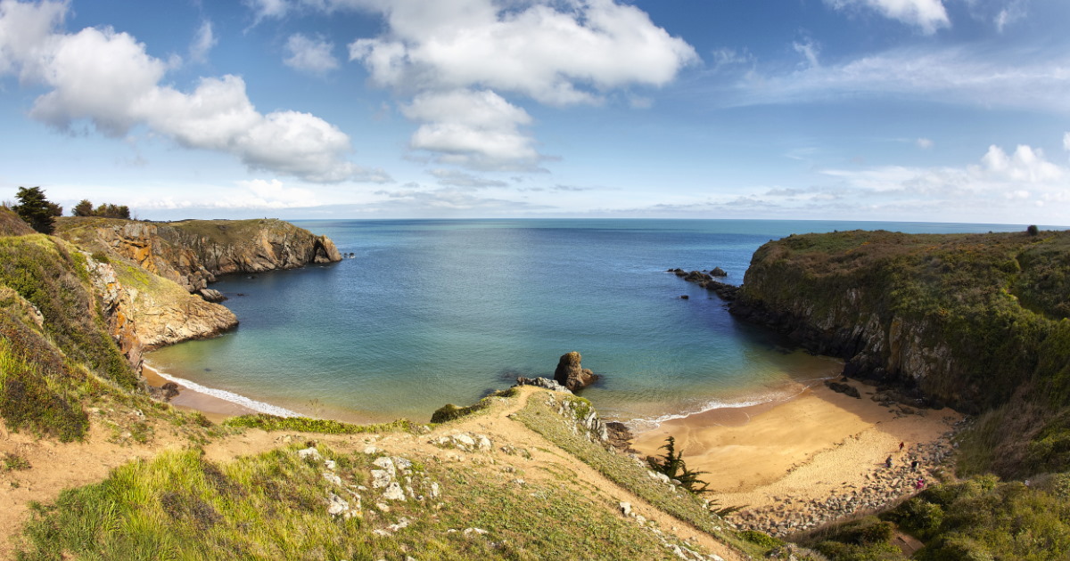
The beaches are certainly inviting, but touring the island one becomes quickly immersed in its history. From an abundance of menhirs and dolmen dating back to Neolithic times, to the impressive medieval Vieux-Chateau, the chapels, a fort, windmills, lighthouses, and shipwrecks, there is no shortage of opportunity for sightseeing on land or in the ocean.
Known from the 6th century as 'Oya' the island saw its first signs of Christianity with a community started by the abbot Martin of Vertou (527–601). This was followed by the construction of a monastery founded by a congregation of Irish monks, dedicated to Saint-Hilaire. These monks cleared the island's forest to begin cultivating the soil but their abbey was destroyed in a Viking invasion in the IXth century.
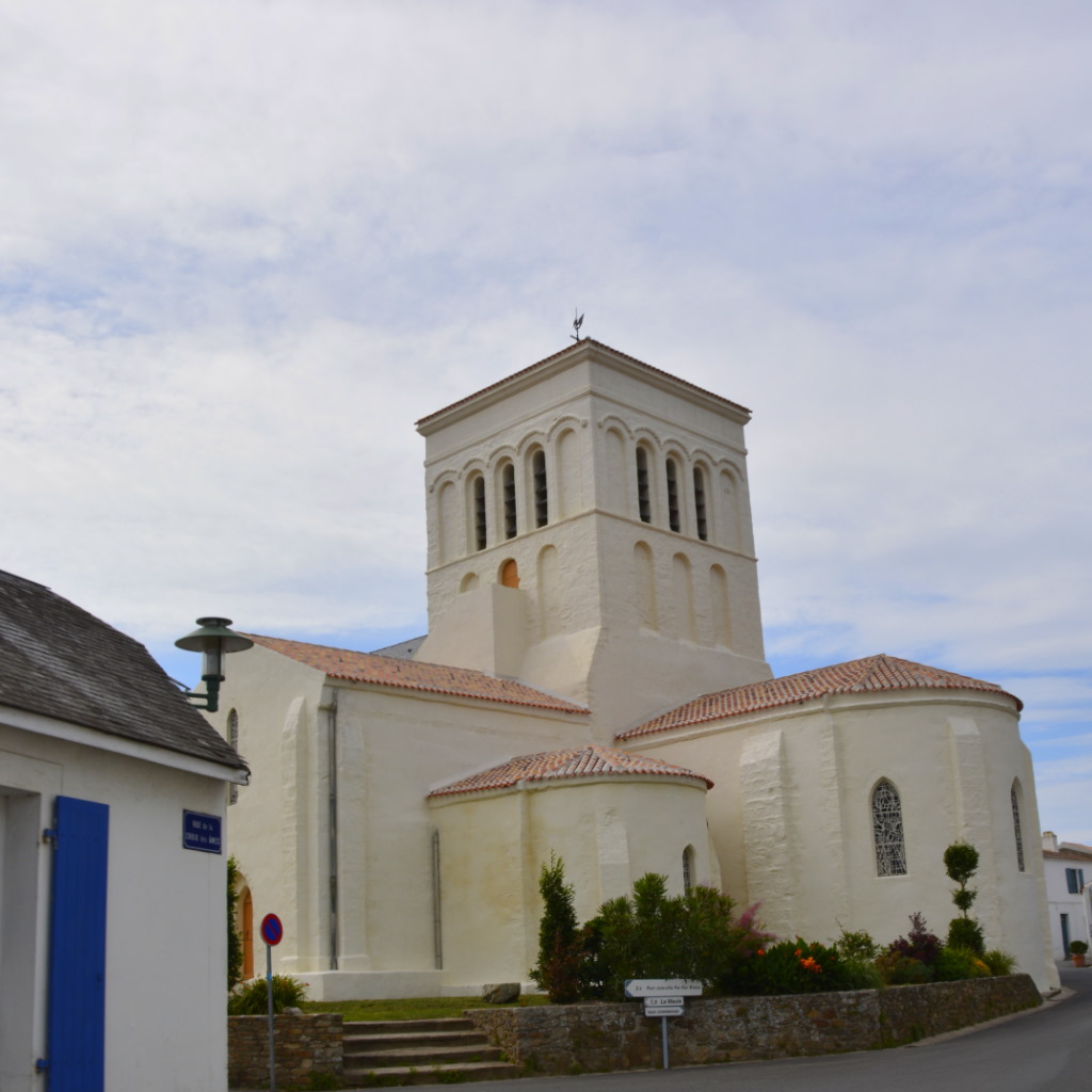
In the Xth century, a new monastery built by religious congregations from Marmoutier (Tours) and Saint-Cyprien (Poitiers) was dedicated to Saint-Stephen. These monks built the church of Saint-Saveur around which the settlement grew that is still there today.
In the Hundred Years war that marked medieval times a rather impressive defensive castle was constructed by order of the French Lords that governed the island. The English were unimpressed, invading the island in 1355. They remained in power for 37 years until French nobleman Olivier de Clisson took the island back.
How to get there – A very long time ago the island was attached to the Vendée mainland via a rocky road called le Pont d'Yeu but as sea levels rose, passage to the island was made more difficult. The only way to get there now is by ferry boat from the shores of Fromentine or Saint-Gilles-Croix-de-Vie into Port-Joinville; or by helicopter from Fromentine - Beauvoir sur Merto to Île d'Yeu Aerodrome,. Accessible 365 days per year.
Main image copyright: Copyright Alexandre Lamoureux/ Vendée Expansion
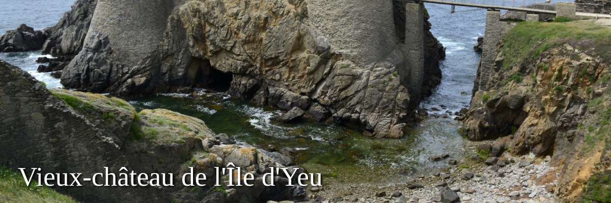
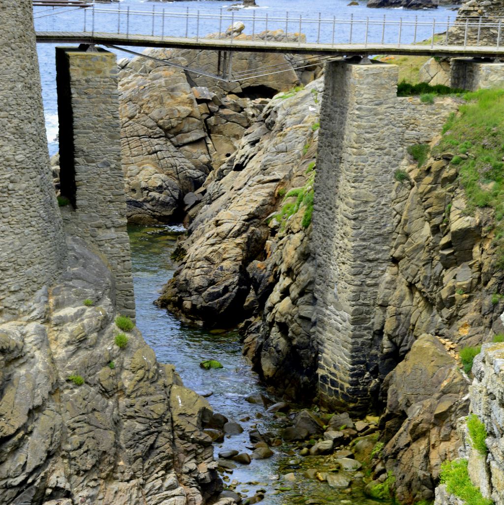
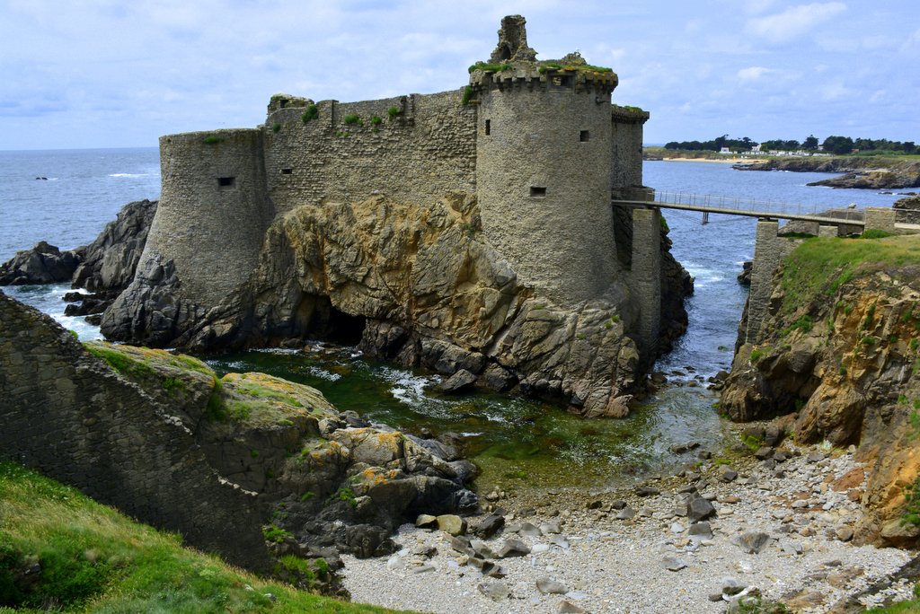
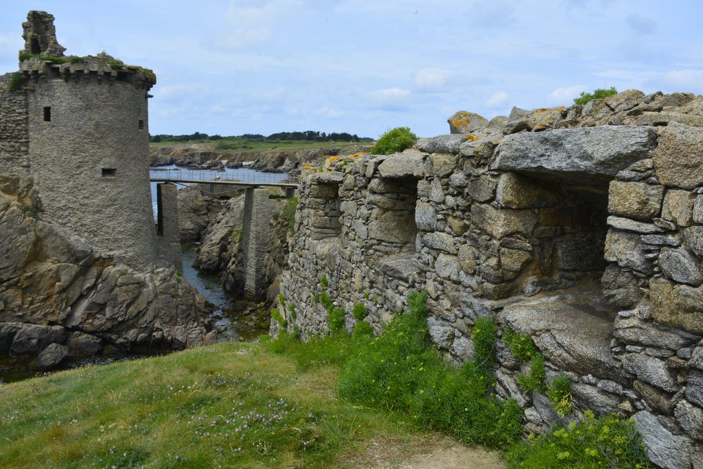
Castle with its feet in the Atlantic Ocean
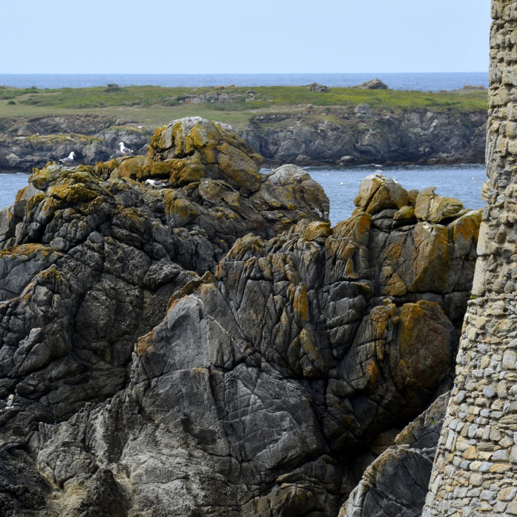
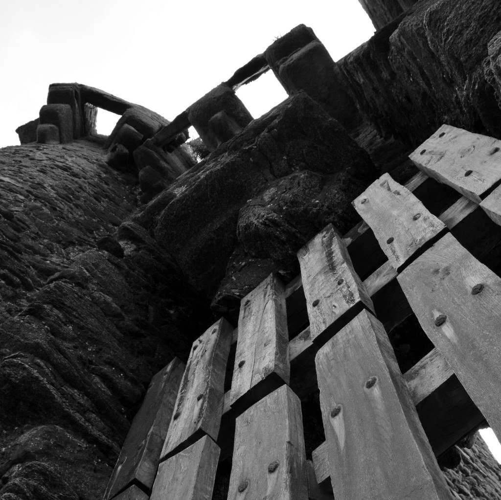
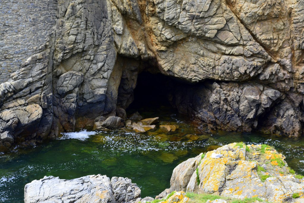
Where a stunning nature reserve and the Atlantic ocean meld together on the island of Yeu (Ile d'Yeu), stands the ruin of le Vieux-Château. Under threat from foreign invasions, this castle was built in the 14th Century by Olivier IV de Clisson to protect the people of Ile d'Yeu.
The longest battle for the castle was actually won by a famous English pirate, Robert Knolles. The mysterious cave beneath the castle does intrigue!
Not only did he seize the castle, he occupied it for thirty-seven years until 1381, when île d'Yeu was reclaimed by by Olivier V de Clisson in the battle of Poitou.
The strategically important castle was once again threatened in 1550 when several thousand Spanish soldiers attacked it from the north. Local soldiers kept it safe. However, the later addition of smaller forts along the French coast proved a more effective strategy for the country. As a result, this amazing castle was one of many demolished at the end of the 17th century by order of Louis XIV, the Sun King.
Pop Culture – Look for the chateau in Hergé's famous Tintin comic book The Black Island.
Open – Year-round. Tour schedule
Tip – NOT easily accessible for less mobile persons.
– Perfect area for picnics and photographic opportunities.
Address – accessible by ferry, then follow signs.
GPS coordinates – 46°43′30″N 2°20′49″W
Nearby sightseeing – Wild coast and nature reserve. We recommend a beautiful walk
Images – by inthevendee.com
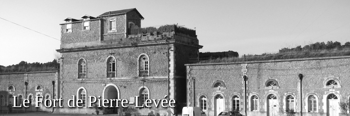
La Citadelle Fort Pierre-Levée
Under the regime of Napoleon III (the Second Empire from 1852 to 1870), a large fort was built from 1858 to 1866 to help defend the French coastal regions. The impressive fort owes its name to a 'standing stone' or prehistoric menhir that stood here called Pierre-Levée.
The fort was built around a large square courtyard with sentry towers at each corner and a glacis (an inclined slope made of earth or stone typical for 19th century military architecture) protecting it from invasion. The building could house up to 400 men.
In its lifetime, the La Citadelle has been a garrison where troops were stationed to protect the location, and it was used as a prison including in WWII when the Germans confiscated the fort to use as an interment camp for left wing government officials. Towards the end of the war, German troops were imprisoned here.
But the fort's most famous inmate was French Marshall Philippe Pétain, a political figure who was found guilty of enemy intelligence and high treason by the French High Court of Justice in 1945. He was imprisoned here for 2052 days until June 1951 when two weeks before his death he was released due to declining health.
In an interesting side-note, the body of Petain was kidnapped from the cemetery in Port-Joinville by sympathizers to be buried elsewhere in France, but they were caught in a manhunt and the Marchal's body was returned to its grave on Ile d'Yeu.
Open – FREE access
Picnic & facilities – yes
Folklore – the menhir after which the fortress was named was demolished and used to build houses on the island. Address – Rue de la Citadelle 85350 L' Île-d'Yeu
GPS coordinates – 46° 43′ 30″ N, 2° 20′ 50″ O
Image – by Stéphane Batigne via Wikimedia
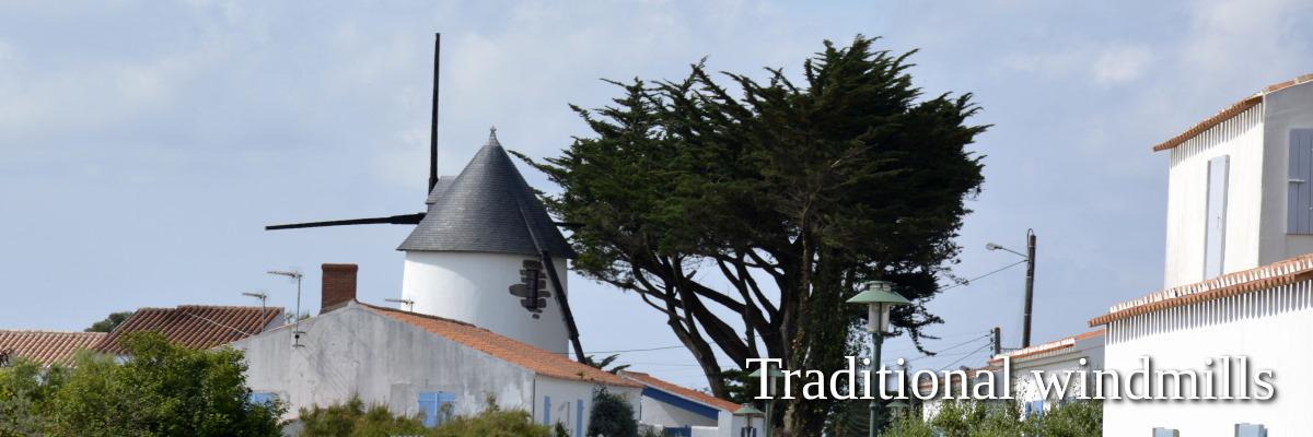
Traditional windmills
The windmill was omni-present in the European landscape and history shows their use wasn't limited to the production of flour. Along the Atlantic coast, fishing boat sailors used the windmills' large white sails to anticipate the direction and speed of the wind.
But the reverse was also true. Millers monitored the boats’ sails for sudden wind shifts. This allowed them to quickly make the necessary adjustments.
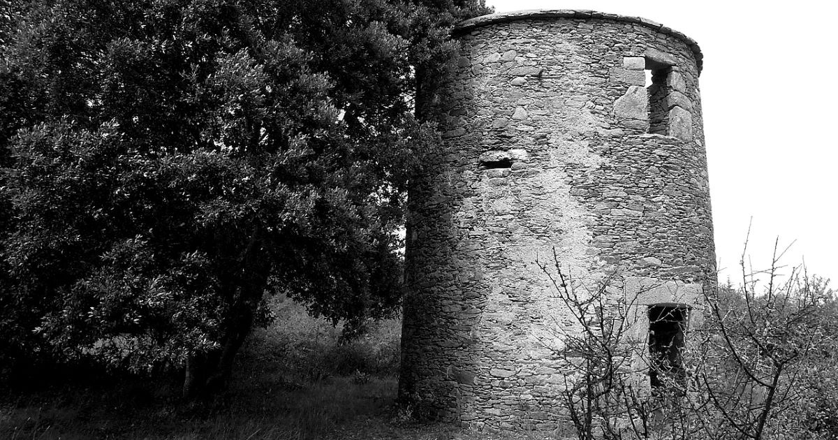
Records show a windmill on the island as early as the XIIIth century, a windmill belonging to the Abbaye de la Blanche. At one point there were 18 windmills on the island, but only five of those remain today, three of which are in ruin**.
The oldest remaining windmill is Moulin le Cassé. The windmill of Grand Chemin appears on an island map in 1695. Moulin Le Camp dates to before the XIXth century but the exact date of construction is unknown. Moulin Le Calvaire was built in 1808 and the Moulin Maingourd dates from 1818.
Through the ages of war and Revolution, the windmills slowly ceased being active, and stopped completely after WWII.
List of windmills – Saint-Sauveur
Moulin Maingourd 46°42'46.5"N 2°20'08.7"W
Port-Joinville
Moulin du Calvaire 46°42'52.0"N 2°20'19.3"W
**Moulin du Grand Chemin 46°42'35.3"N 2°21'03.6"W
**Moulin le Cassé 46°42'35.3"N 2°20'04.1"W
**Moulin le Camp 46°42'40.1"N 2°20'10.2"W
Image Moulin Maingourd – by inthevendee.com
Image Moulin du Grand Chemin by /wikipedia
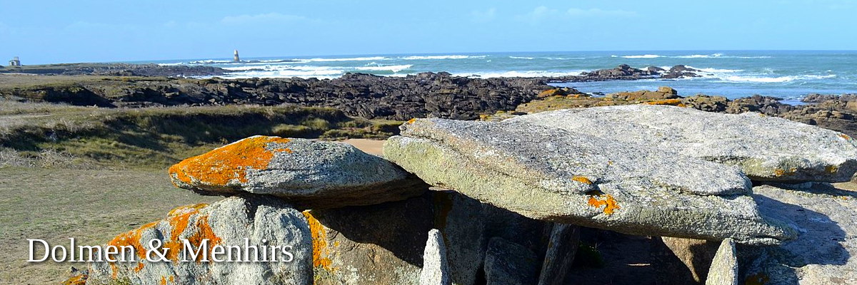
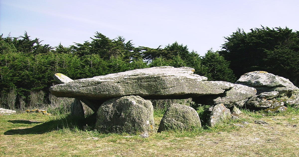
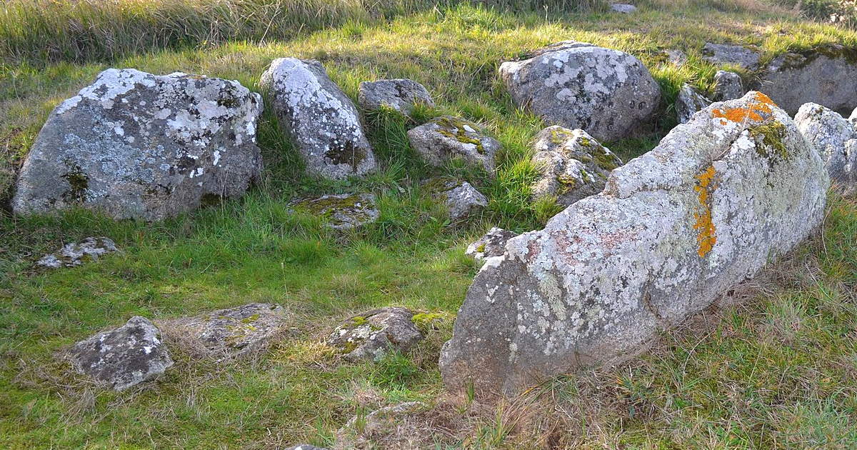
Prehistoric Ile d'Yeu
The prehistory is divided into three stages: the Stone Age, the Bronze Age, and the Iron Age. These consecutive periods are determined by the human sociological progression and evolving e.g. in survival practices, tools and the use of pottery.
The Neolithic transition (when human beings made the progression from foraging to farming) was also a process of migration from the Near East throughout Europe over the course of thousands of years, at an average of 1 km per year (0.6–1.3 km/yr).
While the Neolithic period begins some 12,000 years ago, in Europe it is considered to be from 7000–3000 BC. In the Vendée there is archaeological evidence of prehistoric life from around 6000 BC.
On Ile d'Yeu there is a great deal of evidence people lived here so many thousands of years ago because engraved rocks, dolmen, menhirs as well as bronze and iron weapons tips can be found on the island.
Since the Neolithic period is widely regarded as the cradle of civilization, civilization arrived early to the Vendée!
GPS coordinates – L'Île-d'Yeu
Allée couverte des Tabernaudes – 46° 43′ 35″ N, 2° 22′ 59″ O
Dolmen de la Guette – 46° 41′ 50″ N, 2° 19′ 40″ O
Dolmen de la Planche-à-Puare – 6° 43′ 38″ N, 2° 23′ 22″ O
Dolmen des Landes – 46° 41′ 52″ N, 2° 20′ 05″ O
Dolmen des Petits Fradets – 46° 43′ 53″ N, 2° 22′ 47″ O
Menhir du Chiron Lazare – 46° 42′ 24″ N, 2° 22′ 22″ O
Menhir du Sud – 46° 41′ 33″ N, 2° 19′ 24″ O
Pierre des Quatre-Chemins – 46° 42′ 41″ N, 2° 21′ 01″ O
Images – by and via wikimedia
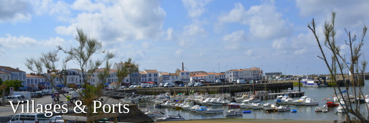
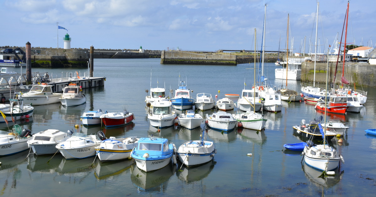
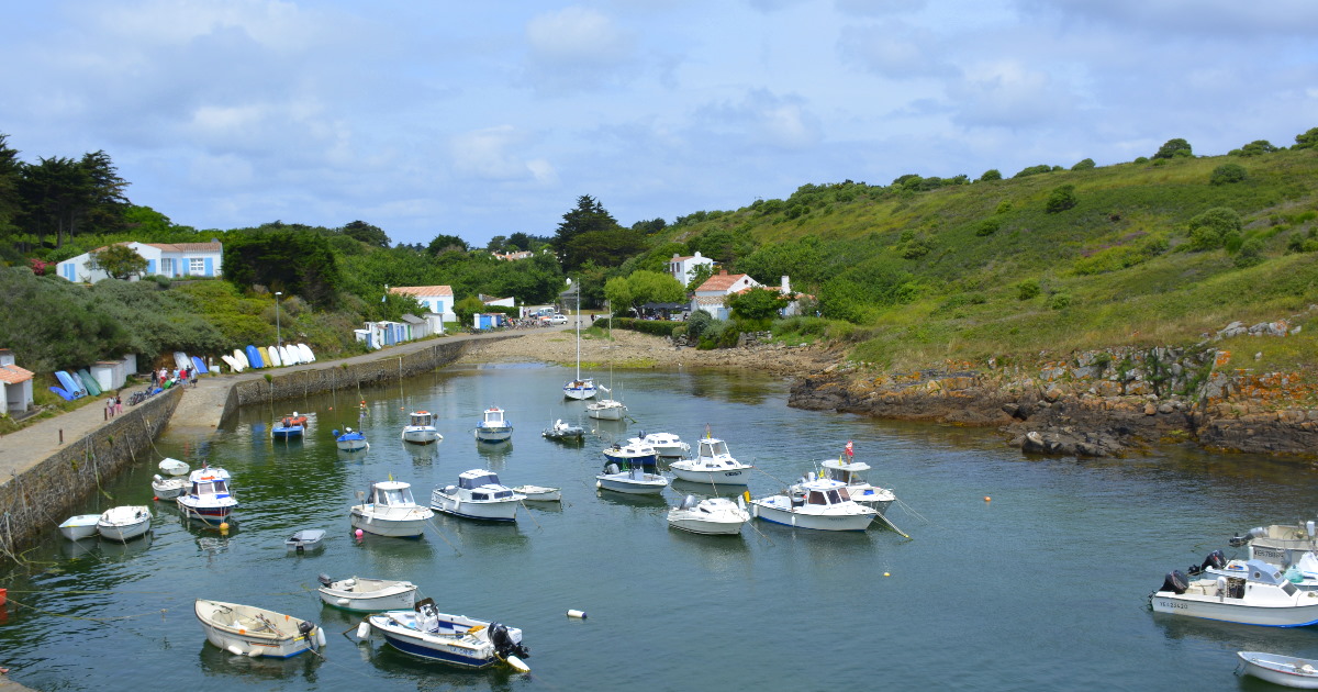
Villages & Ports
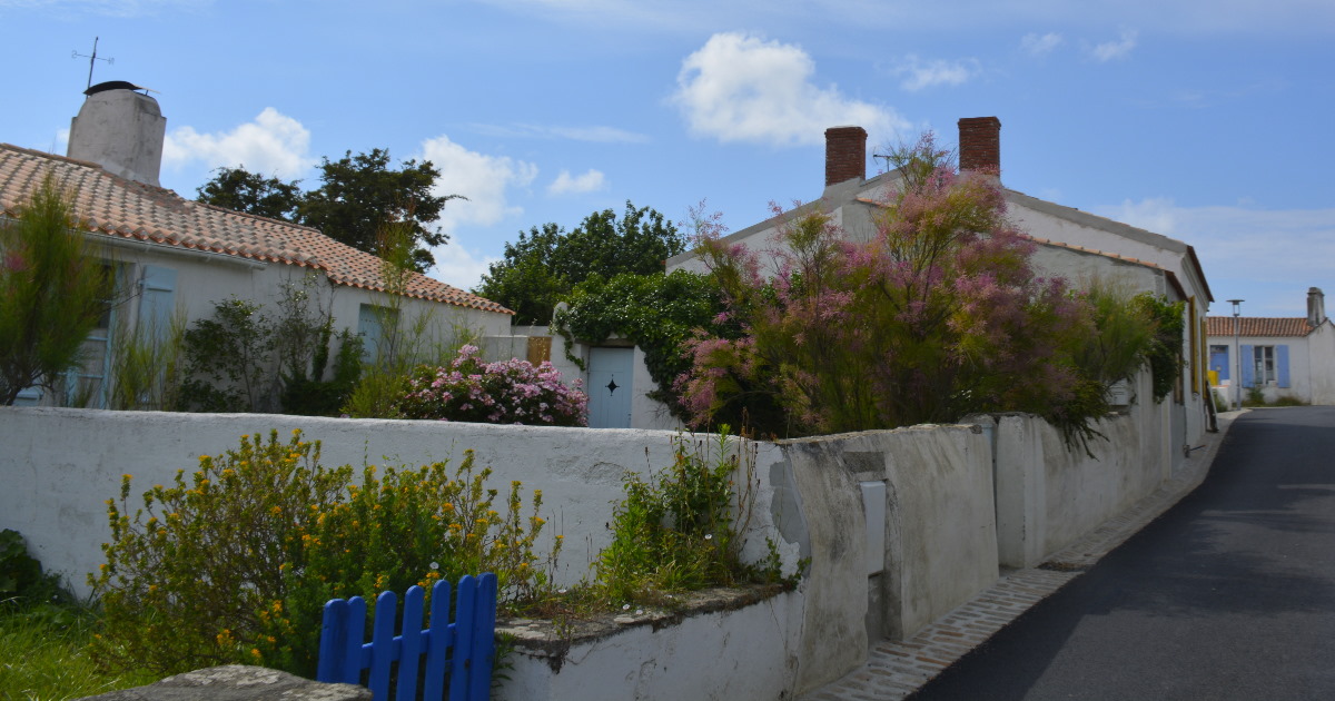
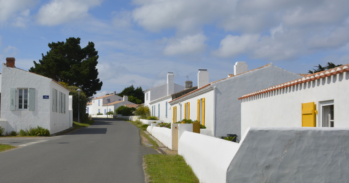
One can count the villages and ports of Île d'Yeu on one hand, and the words to describe them are perhaps: joy, colourful, happy, joie de vivre and wow, it's like the Greek islands have landed in France.
No matter what form of transportation you choose, with a sunny breeze on your skin touring the island feels like having discovered a small slice of heaven.
Everywhere you look is a feast for the eyes and the senses. How can everything you've ever wanted in a holiday be compacted in just 23 sq km? Don't take our word for it, go and see for yourselves!
The 5000 or so islanders are spread over three villages across the island: Port Joinville is the ferry port located in the north; Saint-Saveur in the center is recognizable by the bright white Romanesque church around which the town grew.
Languid strolls down the narrow streets with their little shops, café's and restaurants, reveal funny street names, local folklore and history marked by plaques and signposts.
La Meule, on the other hand is located to the south of the island and feathers from its little port uphill to charming little hamlets and winding streets. From the port, climb up to the ruins of a medieval tower, or the Chapelle de la Meule, for magnificent views of the Côte Sauvage (the wild coast) and the Atlantic Ocean.
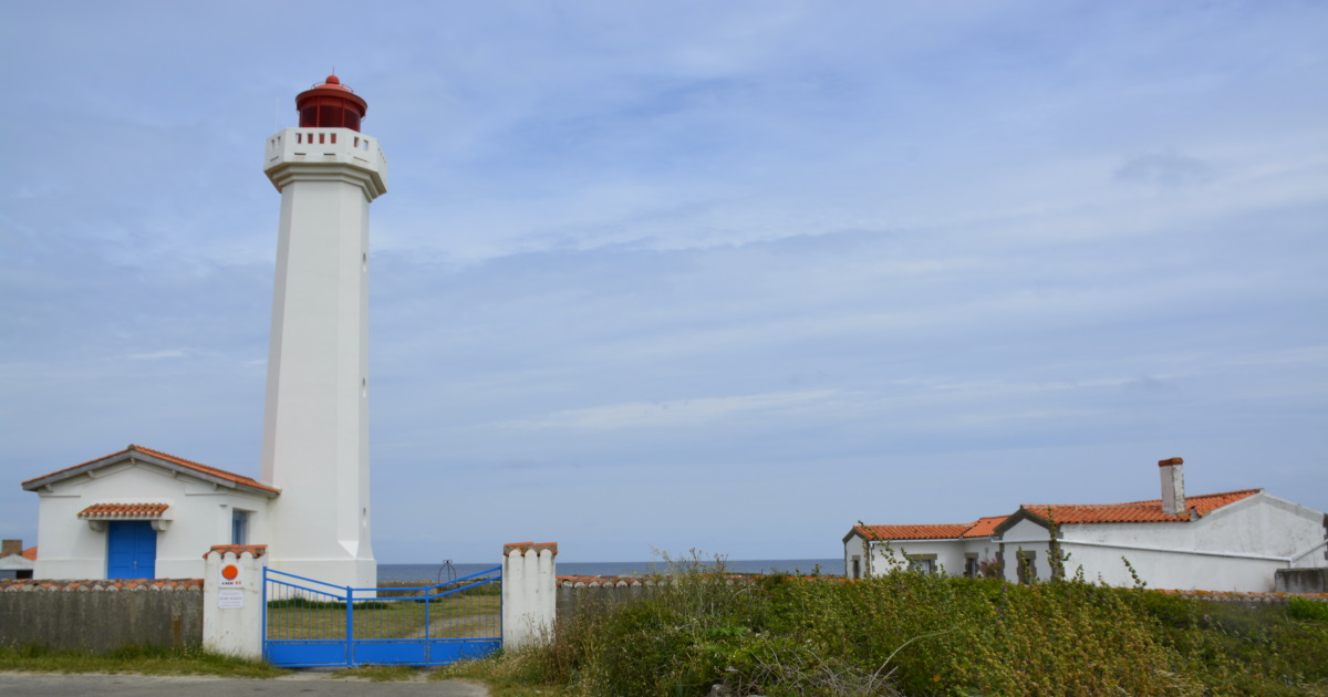
Many of the island's lighthouses were destroyed in WWII under German occupation, and later rebuilt. Tours are organized daily throughout the season.
Markets – Port Joinville and Saint-Saveur (every day in summer). Local producers
Local Delicacies – Prune tart, locally raised lamb, fish, and betchet, a breakfast roll
Tip – 2-day International Jazz & Blues Festival in August (canceled in 2020)
Photography – did we mention heaven?
Wedding proposals and birthdays – ideal
Restaurants and café's – see planning section
Lighthouses – Grand Phare 46°43′03″N 2°22′56″W
Pointe des Corbeaux 46° 41′ 21,57″ N, 2° 17′ 03,78″ O
Phare des Mariés, Lighthouses of the Port, and Grand Quay or Quai du Canada (village Port Joinville)
Image credits by inthevendee
Image Grand Phare interior by / wikipedia


Planning
Sightseeing, is so relaxed and fun here. While we would typically encourage our readers to explore without too much planning, on a day trip to Ile d'Yeu you'll not want to miss the ferry back to the mainland. That's why we do recommend 'some' planning ahead.
When renting a car, be aware you will be dodging cyclists all day long which can prove dangerous especially with children wobbling about, and it will slow you down significantly.
The best way to explore the island is by cycling or scootering. For a leisurely tour we suggest a loop around the island via the coastal route and randomly following signs for historical monuments. You'll catch a bit of everything that way.
You'll want to reserve bicycles or scooter ahead of time if that's how you plan to explore the island. When cycling, know your limits and that of your family. While the island is only 23.32 km2 (9.00 sq mi) with max. elevation of 32m (105ft).
To truly visit the historical sites, you'll need to plan ahead and map/ time it out which makes the tour less relaxing.
Restaurants for every budget are located in the main port. There is a bistro in La Meule which serves scrumptious meals, all locally sourced, with a star-level presentation. It's a bit of a splurge and could be expensive 'en famile' ($$-$$$) but upon arrival at Port-Joinville, it is possible to buy sandwiches and drinks for a picnic. Being spontaneous allows us to travel deeper and capture the unexpected.
Ferry reservations – typically by catamaran (30 min) Compagnie Vendeenne Ile d'Yeu
Compagnie Yeu-Continent
Helicopter reservations – Oya Helicopter services
Local transportation – Bike rentals. Scooter hire are typically done here as well. Car hire please Google 'car hire or car rental Ile d'Yeu'
Using your own bicycles – it is possible to take your bike on the ferry but we found it doesn't make much financial sense, comparing cost vs. logistics vs. travel budget. For 2 people, on a day trip, we found renting a scooter the best option. See companies listed above
Where to eat – a list of restaurants here
Pharmacie – Port Joinville website and the terminology to use for 'motion sickness medication' is Mal de Mer (also a brand, works well)
Watersports – information & reservations for kayaking, deep-sea fishing, diving, surfing etc here
Image by inthevendee.com
France's best kept secret?
Do we need to present more proof that the Vendée is France's best kept secret, and considered one of the most beautiful islands in French territory?
Ile d'Yeu is a true gem of France's Atlantic coast. Let surprise you! At low tide it reveals even more of its secrets with a giant WWII shipwreck right in front of the coast at Port Joinville. It's but one of hundreds of photo-ops the island will gift to you. That and the feeling that as soon as you've left, you'll want to visit again. And again.
Please check back for updates to this article and of course, if there's something you think we ought to see, leave a post or a comment on our Facebook page!
Main image by: inthevendee.com
Copyright Alexandre Lamoureux/ Vendée Expansion
Copyright all images except where mentioned otherwise inthevendee.com
Share this Post